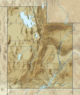
Flat Top Mountain (Utah)
Appearance
| Flat Top Mountain | |
|---|---|
 Flat Top Mountain - Looking north from near Five Mile pass | |
| Highest point | |
| Elevation | 10,613 ft (3,235 m)[1] |
| Prominence | 5,370 ft (1,640 m)[2] |
| Parent peak | Deseret Peak |
| Isolation | 23.6 mi (38.0 km)[2] |
| Coordinates | 40°22′21″N 112°11′21″W / 40.37250°N 112.18917°W[1] |
| Geography | |
| Location | Utah and Tooele Counties, Utah |
| Parent range | Oquirrh Mountains |
Flat Top Mountain is a 10,624-foot (3,238 m) peak in Utah and Tooele Counties, Utah in the United States, about 15 miles (24 km) to the east of Rush Valley.
With a prominence of approximately 5,370-foot (1,640 m), it is the sixth most prominent peak in Utah. It is the highest point of the Oquirrh Mountains.[2]
Flat Top Mountain overlooks Lehi, American Fork and the entire northern Utah county area. It can be seen everywhere in the greater Salt Lake Basin area.
Climate
[edit]| Climate data for Flat Top Mountain (UT) 40.4245 N, 112.1993 W, Elevation: 10,095 ft (3,077 m) (1991–2020 normals) | |||||||||||||
|---|---|---|---|---|---|---|---|---|---|---|---|---|---|
| Month | Jan | Feb | Mar | Apr | May | Jun | Jul | Aug | Sep | Oct | Nov | Dec | Year |
| Mean daily maximum °F (°C) | 28.3 (−2.1) |
29.2 (−1.6) |
34.4 (1.3) |
40.4 (4.7) |
50.0 (10.0) |
62.4 (16.9) |
71.7 (22.1) |
70.0 (21.1) |
60.6 (15.9) |
47.6 (8.7) |
34.9 (1.6) |
27.8 (−2.3) |
46.4 (8.0) |
| Daily mean °F (°C) | 20.0 (−6.7) |
20.0 (−6.7) |
24.6 (−4.1) |
29.6 (−1.3) |
38.8 (3.8) |
49.7 (9.8) |
58.7 (14.8) |
57.9 (14.4) |
49.1 (9.5) |
37.4 (3.0) |
26.4 (−3.1) |
19.7 (−6.8) |
36.0 (2.2) |
| Mean daily minimum °F (°C) | 11.7 (−11.3) |
10.8 (−11.8) |
14.8 (−9.6) |
18.8 (−7.3) |
27.5 (−2.5) |
37.1 (2.8) |
45.8 (7.7) |
45.8 (7.7) |
37.6 (3.1) |
27.2 (−2.7) |
17.9 (−7.8) |
11.6 (−11.3) |
25.6 (−3.6) |
| Average precipitation inches (mm) | 4.52 (115) |
4.51 (115) |
5.15 (131) |
5.41 (137) |
3.95 (100) |
1.81 (46) |
1.29 (33) |
1.41 (36) |
2.09 (53) |
3.21 (82) |
3.75 (95) |
4.38 (111) |
41.48 (1,054) |
| Source: PRISM Climate Group[3] | |||||||||||||
See also
[edit]References
[edit]- ^ a b U.S. Geological Survey Geographic Names Information System: Flat Top Mountain (Utah)
- ^ a b c Flat Top Mountain (Utah) at Peakbagger.com
- ^ "PRISM Climate Group, Oregon State University". PRISM Climate Group, Oregon State University. Retrieved November 6, 2023.
To find the table data on the PRISM website, start by clicking Coordinates (under Location); copy Latitude and Longitude figures from top of table; click Zoom to location; click Precipitation, Minimum temp, Mean temp, Maximum temp; click 30-year normals, 1991-2020; click 800m; click Retrieve Time Series button.

