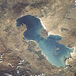
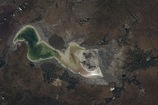
File:Urmia lake drought.webm
Appearance
Size of this JPG preview of this WEBM file: 400 × 600 pixels. Other resolutions: 160 × 240 pixels | 320 × 480 pixels | 720 × 1,080 pixels.
Original file (WebM audio/video file, VP8/Vorbis, length 15 s, 720 × 1,080 pixels, 867 kbps overall, file size: 1.56 MB)
| This is a featured picture, which means that members of the community have identified it as one of the finest images on the English Wikipedia, adding significantly to its accompanying article. If you have a different image of similar quality, be sure to upload it using the proper free license tag, add it to a relevant article, and nominate it. |
| This image was selected as picture of the day on the English Wikipedia for September 20, 2017. |
File history
Click on a date/time to view the file as it appeared at that time.
| Date/Time | Thumbnail | Dimensions | User | Comment | |
|---|---|---|---|---|---|
| current | 10:02, 22 July 2014 | 15 s, 720 × 1,080 (1.56 MB) | مانفی | {{Information |Description=Urmia_lake_drought |Source=http://eol.jsc.nasa.gov/scripts/sseop/QuickView.pl?directory=ISD&ID=STS41G-37-85 , http://eol.jsc.nasa.gov/scripts/sseop/QuickView.pl?directory=ESC&ID=ISS027-E-9990 , http://eol.jsc.nasa.gov/scripts... |
File usage
The following 12 pages use this file:
- List of drying lakes
- Talk:Lake Urmia
- User talk:Crisco 1492/Archive 57
- User talk:Crisco 1492/Archive 58
- User talk:مانفی
- Wikipedia:Featured picture candidates/February-2015
- Wikipedia:Featured picture candidates/Lake Urmia losing water
- Wikipedia:Featured pictures/Space/Looking back
- Wikipedia:Featured pictures thumbs/47
- Wikipedia:Main Page history/2017 September 20
- Wikipedia:Picture of the day/September 2017
- Template:POTD/2017-09-20
Global file usage
The following other wikis use this file:
- Usage on als.wiki.x.io
- Usage on az.wiki.x.io
- Usage on bh.wiki.x.io
- Usage on bn.wikibooks.org
- Usage on ca.wiki.x.io
- Usage on ckb.wiki.x.io
- Usage on da.wiki.x.io
- Usage on de.wiki.x.io
- Usage on et.wiki.x.io
- Usage on eu.wiki.x.io
- Usage on fa.wiki.x.io
- Usage on fa.wikibooks.org
- Usage on fr.wiki.x.io
- Usage on hy.wikibooks.org
- Usage on incubator.wikimedia.org
- Usage on pt.wiki.x.io
- Usage on sv.wiki.x.io
- Usage on tt.wiki.x.io
- Usage on uk.wiki.x.io
- Usage on www.wikidata.org


