
Dobrowolski, Texas
Dobrowolski, Texas | |
|---|---|
 Dobrowolski  Dobrowolski | |
| Coordinates: 28°53′34″N 98°38′34″W / 28.8927523°N 98.6427988°W | |
| Country | United States |
| State | Texas |
| County | Atascosa |
| Elevation | 522 ft (159 m) |
| Time zone | UTC-6 (Central (CST)) |
| • Summer (DST) | UTC-5 (CDT) |
| Area code | 830 |
| GNIS feature ID | 1356092[1] |
Dobrowolski is a ghost town in Atascosa County, in the U.S. state of Texas.[1] According to the Handbook of Texas, the community had a population of 10 in 2000. It is located within the San Antonio metropolitan area.
Geography
[edit]Dobrowolski was located on Texas State Highway 97, 6 mi (9.7 km) southwest of Jourdanton in west-central Atascosa County.[2]
Education
[edit]The school joined the Charlotte Independent School District in 1936.[2] The community is served by the Charlotte ISD to this day.
References
[edit]- ^ a b c U.S. Geological Survey Geographic Names Information System: Dobrowolski, Texas
- ^ a b Peterson, Linda. "Dobrowolski, TX". tshaonline.org. Retrieved January 1, 2022.
Municipalities and communities of Atascosa County, Texas, United States | ||
|---|---|---|
| Cities | 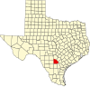 | |
| Town | ||
| CDP | ||
| Other communities | ||
| Ghost towns | ||
| Footnotes | ‡This populated place also has portions in an adjacent county or counties | |