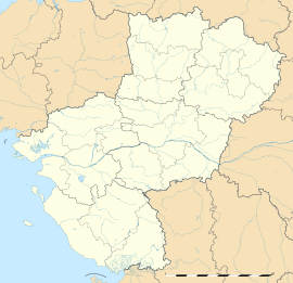
Cugand
Cugand | |
|---|---|
 A replica of the Lourdes Grotto | |
| Coordinates: 47°03′47″N 1°15′12″W / 47.0631°N 1.2533°W | |
| Country | France |
| Region | Pays de la Loire |
| Department | Vendée |
| Arrondissement | La Roche-sur-Yon |
| Canton | Mortagne-sur-Sèvre |
| Intercommunality | CA Terres de Montaigu |
| Government | |
| • Mayor (2020–2026) | Cécile Barreau[1] |
Area 1 | 13.47 km2 (5.20 sq mi) |
| Population (2021)[2] | 3,685 |
| • Density | 270/km2 (710/sq mi) |
| Time zone | UTC+01:00 (CET) |
| • Summer (DST) | UTC+02:00 (CEST) |
| INSEE/Postal code | 85076 /85610 |
| Elevation | 13–71 m (43–233 ft) |
| 1 French Land Register data, which excludes lakes, ponds, glaciers > 1 km2 (0.386 sq mi or 247 acres) and river estuaries. | |
Cugand (French pronunciation: [kyɡɑ̃]) is a commune in the Vendée department in the Pays de la Loire region in western France.
Before the creation of the departments with the French Republic, under the French Kingdom, the parish of Cugand was part of "Marches Bretagne-Poitou" (joint possession) and of Brittany on the religious level (Roman Catholic Diocese of Nantes).
It is part of the urban unit of Clisson.[3]
The commune of Cugand will merge with the nearby commune of La Bernardière in 2025 to form the commune of Cugand-La Bernardière.
Geography
[edit]Cugand is located along the Sèvre Nantaise, 28 km south-east of Nantes and 29 km south-west of Cholet.
Its neighboring communes are:
- In Vendée
- In Loire-Atlantique :
Climate
[edit]In 2020, Météo-France has published a typology of the climates of Metropolitan France in which Cugand is exposed to an Oceanic climate and located in the "Bretagne Orientale et Méridionale, Pays Nantais, Vendée" climatic region where the amount of rainfall is low in summer and the insolation is good.[4]
Population
[edit]| Year | Pop. | ±% p.a. |
|---|---|---|
| 1968 | 2,199 | — |
| 1975 | 2,425 | +1.41% |
| 1982 | 2,525 | +0.58% |
| 1990 | 2,627 | +0.50% |
| 1999 | 2,776 | +0.61% |
| 2010 | 3,269 | +1.50% |
| 2015 | 3,448 | +1.07% |
| 2021 | 3,685 | +1.11% |
| Source: INSEE[5] | ||
Local life
[edit]Sport
[edit]- Sportive Union Bernardière Cugand : football division
- Basketball Association Cugand Bernardière : basketball division
- St Michel Handball : handball division
- "Les raquettes Cugandaises" : tennis division
- Athlétisme Mingot Association : athletics division
- TTAL Cugand : table tennis division
Health
[edit]- Health Center Les Caducées
Schools
[edit]- Private elementary school St Michel / Jeanne d'Arc
- Public elementary school Jean Moulin
Culture
[edit]- Cugandan library
- World dance and music festival
Events
[edit]- "Festival de Cugand", world dance and music, folk bands of the all world, during 4 days in August (20,000 spectators in 2005 for the 7th festival edition)
See also
[edit]References
[edit]- ^ "Répertoire national des élus: les maires". data.gouv.fr, Plateforme ouverte des données publiques françaises (in French). 2 December 2020.
- ^ "Populations légales 2021" (in French). The National Institute of Statistics and Economic Studies. 28 December 2023.
- ^ Commune de Cugand (85076), INSEE
- ^ archive.wikiwix.com http://archive.wikiwix.com/cache/index2.php?url=http://pluiesextremes.meteo.fr/france-metropole/Un-peu-de-geographie.html#federation=archive.wikiwix.com&tab=url. Retrieved 2024-08-09.
{{cite web}}: Missing or empty|title=(help) - ^ [1], INSEE


