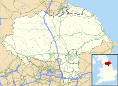
Coneythorpe
Appearance
| Coneythorpe | |
|---|---|
 Tiger Inn | |
Location within North Yorkshire | |
| OS grid reference | SE393589 |
| • London | 180 mi (290 km) SSE |
| Civil parish | |
| Unitary authority | |
| Ceremonial county | |
| Region | |
| Country | England |
| Sovereign state | United Kingdom |
| Post town | KNARESBOROUGH |
| Postcode district | HG5 |
| Police | North Yorkshire |
| Fire | North Yorkshire |
| Ambulance | Yorkshire |
Coneythorpe is a village in the civil parish of Coneythorpe and Clareton, in North Yorkshire, England. It is situated less than 1 mile (1.6 km) west from the A1(M) motorway. Until 1974 it was in the West Riding of Yorkshire. From 1974 to 2023 it was in Harrogate district.
Coneythorpe was formerly a township in the parish of Goldsborough,[1] in 1866 Coneythorpe became a separate civil parish,[2] on 24 March 1888 the parish was abolished and merged with Clareton to form "Coneythorpe and Clareton".[3] In 1881 the parish had a population of 79.[4]
References
[edit]- ^ "History of Coneythorpe, in Harrogate and West Riding". A Vision of Britain through Time. Retrieved 8 December 2023.
- ^ "Relationships and changes Coneythorpe CP/Tn through time". A Vision of Britain through Time. Retrieved 8 December 2023.
- ^ "Relationships and changes Coneythorpe CP/Tn through time". A Vision of Britain through Time. Retrieved 8 December 2023.
- ^ "Population statistics Coneythorpe CP/Tn through time". A Vision of Britain through Time. Retrieved 8 December 2023.
External links
[edit] Media related to Coneythorpe at Wikimedia Commons
- Coneythorpe at Streetmap.co.uk

