Coesse Corners, Indiana
Appearance
Coesse Corners, Indiana | |
|---|---|
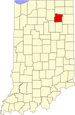
 Whitley County's location in Indiana | |
| Coordinates: 41°08′21″N 85°23′45″W / 41.13917°N 85.39583°W | |
| Country | United States |
| State | Indiana |
| County | Whitley |
| Township | Union |
| Elevation | 863 ft (263 m) |
| Time zone | UTC-5 (Eastern (EST)) |
| • Summer (DST) | UTC-4 (EDT) |
| ZIP code | 46725 |
| Area code | 260 |
| GNIS feature ID | 432730 |
Coesse Corners is an unincorporated community in Union Township, Whitley County, in the U.S. state of Indiana.[2]
Geography
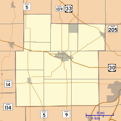
[edit]Coesse Corners is located at 41°08′21″N 85°23′45″W / 41.13917°N 85.39583°W, on the Lincoln Highway just north of Coesse.[3]
References
[edit]- ^ "US Board on Geographic Names". United States Geological Survey. October 25, 2007. Retrieved June 17, 2016.
- ^ "Coesse Corners, Indiana". Geographic Names Information System. United States Geological Survey. Retrieved July 24, 2017.
- ^ Baker, Ronald L. (October 1995). From Needmore to Prosperity: Hoosier Place Names in Folklore and History. Indiana University Press. p. 99. ISBN 978-0-253-32866-3.
This village is located just north of Coesse...


