
Chilubi District
Chilubi District | |
|---|---|
 District location in Zambia | |
| Country | |
| Province | Northern Province |
| Capital | Chilubi |
| Area | |
| • Total | 5,169.6 km2 (1,996.0 sq mi) |
| Population (2022) | |
| • Total | 114,011 |
| • Density | 22/km2 (57/sq mi) |
| Time zone | UTC+2 (CAT) |
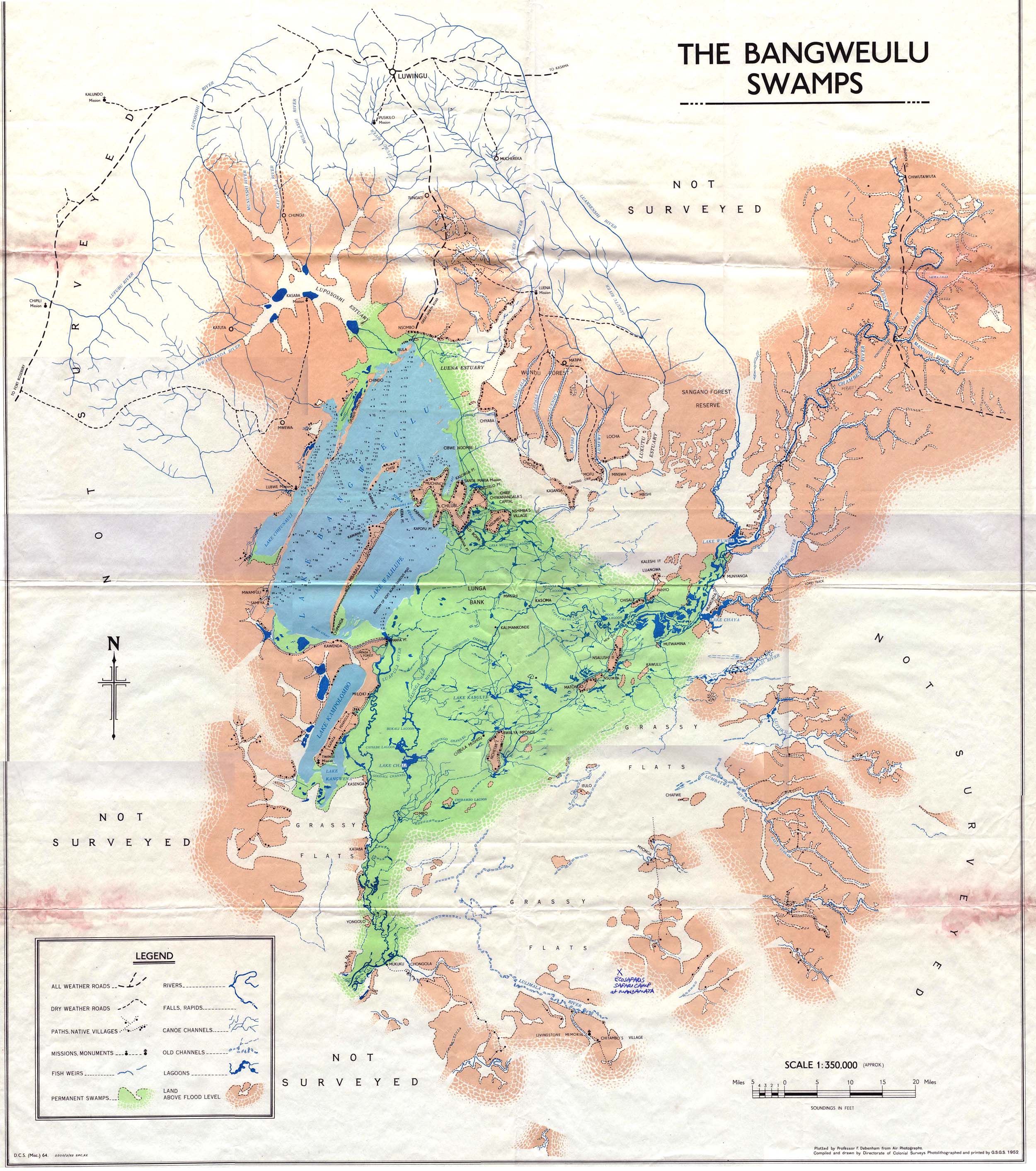
Chilubi District with headquarters at Chilubi is located in Northern Province, Zambia. It covers the north-east Lake Bangweulu and Bangweulu Wetlands containing several islands including Chilubi Island, and some of the mainland northeast of the lake. As of the 2022 Zambian Census, the district had a population of 114,011 people.[1]
Other islands in Chilubi District include Chichile, Kasansa, Panyo Island and Luangwa, all at the edges of the swamps where they dry out sufficiently in the dry season to form a connection to the mainland.[2]
Isangano National Park lies in the east of the district but it has no management and most of the wildlife has been poached out.[3]
References
[edit]- ^ 2022 Census of Population and Housing - Preliminary Report (PDF)
- ^ Map of Bangweulu Swamps, NRZAM.org, Directorate of Colonial Surveys, (1952). Accessed 24 April 2007.
- ^ Camerapix: "Spectrum Guide to Zambia." Camerapix International Publishing, Nairobi, 1996.
| Central Province | |
|---|---|
| Copperbelt Province | |
| Eastern Province | |
| Luapula Province | |
| Lusaka Province | |
| Muchinga Province | |
| Northern Province | |
| North-Western Province | |
| Southern Province | |
| Western Province | |
| International | |
|---|---|
| National | |