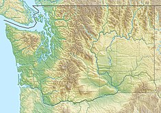
Casad Dam
| Casad Dam | |
|---|---|
 Casad Dam (near center) and Union River reservoir | |
| Country | United States |
| Location | Bremerton, Washington |
| Coordinates | 47°32′17″N 122°46′47″W / 47.53806°N 122.77972°W |
| Purpose | Municipal water supply[1] |
| Status | Operational |
| Construction began | 1955 |
| Opening date | 1957 |
| Construction cost | $1.4 million[2] |
| Owner(s) | City of Bremerton |
| Dam and spillways | |
| Type of dam | Concrete arch |
| Impounds | Union River |
| Height | 190 ft (58 m) |
| Length | 416 ft (127 m) |
| Elevation at crest | 643.7 ft (196.2 m) |
| Width (base) | 56 ft (17 m) |
| Reservoir | |
| Creates | Union River Reservoir |
| Total capacity | 1,400,000,000 US gal (5,300,000 m3) |
| Catchment area | 3,000 acres (1,200 ha) |
| Surface area | 40 acres (16 ha) |
| Normal elevation | 607 ft (185 m)[3] |
| Coordinates from USGS,[4] specifications from factsheet[5] unless noted | |
Casad Dam is a concrete arch dam in Bremerton, Kitsap County, Washington), built starting in 1955 and completed in 1957.[6][7]
The dam is Kitsap County's only major water diversion structure,[8] impounding Union River to form a reservoir that is the source of over half of Bremerton's municipal water supply.[5] The water is gravity fed from the reservoir at 607 feet (185 m) in the hills[3] to the city, most of which is at or near sea level.[9]
Bremerton owns 95% of the land in its 3,000-acre (1,200 ha) watershed, and the Union River reservoir behind Casad Dam holds 1,400,000,000 US gallons (5,300,000 m3) of water.[6] The city is unusual in drawing most of its water supply from an open air source, the reservoir, which can occasionally be affected by algal blooms.[10]
The dam's intake tower underwent seismic retrofit in 2012 to withstand a 0.78 g peak acceleration in a maximum credible earthquake from the Seattle Fault which runs about four miles (7 km) away, on the north side of Green Mountain.[11][12]
References
[edit]- ^ Secondary use as flood control: Garrett W. Jackson (February 2008), Site and Reach Assessment, Union River At SR 300 (PDF), Washington State Department of Transportation Environmental Services, archived from the original (PDF) on 2014-09-02
- ^ C. Cliff Casad; John W. Cunningham (May 2, 1957), "Construction of the Union River Dam at Bremerton, Wash.", Journal (American Water Works Association), 50 (1), American Water Works Association: 105–109, JSTOR 41254984
- ^ a b U.S. Geological Survey Geographic Names Information System: Union River Reservoir
- ^ U.S. Geological Survey Geographic Names Information System: Casad Dam
- ^ a b Casad Dam factsheet, City of Bremerton Public Works and Utilities, archived from the original on 2014-12-23, retrieved 2014-10-23
- ^ a b Bremerton's water history, City of Bremerton, archived from the original on 2012-11-11, retrieved 2014-10-23
- ^ State of Salmon in Watersheds 2012 Report, State of Washington Recreation and Conservation Office and Governor's Salmon Recovery Office, 2012, archived from the original on 2014-11-20, retrieved 2014-10-24
- ^ Kitsap County initial basin assessment (PDF), Kitsap County Public Utility District, October 1997, archived from the original (PDF) on 2014-10-24, retrieved 2014-10-24
- ^ Josh Farley (February 17, 2013), "In Bremerton, cascade of utility rate hikes awaits", Puget Sound Blogs, Kitsap Sun, archived from the original on October 24, 2014, retrieved October 24, 2014
- ^ "Algae bloom caues 'metallic' taste in Bremerton's water supply", Puget Sound Blogs, Kitsap Sun, June 5, 2014
- ^ Kimberley Robinson (August 2012), "Brace Yourself! Novel Uses for the Buckling Restrained Brace", Structure, National Council of Structural Engineers Associations, archived from the original on 2014-10-24
- ^ Lee M. Liberty (June 30, 2009), The western extension of the Seattle fault: new insights from seismic reflection data (PDF), U.S. Geological Survey, archived from the original (PDF) on 2017-01-28, retrieved 2017-08-28

