Cappataggle
This article needs additional citations for verification. (November 2024) |

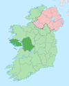
Cappataggle (Irish: Ceapach an tSeagail) is a village located between the towns of Loughrea and Ballinasloe in east County Galway.[1] With the areas Kilrickle and Killalaghton it forms a parish of the same name. The name Cappataggle is an anglicisation of the Irish name Ceapach an tSeagail, which translates as ‘meadow of rye’.[2] The village is centred on many dairy, livestock and tillage farms. The new M6 Galway to Dublin motorway toll plaza is located a half km from the village.[3]
The village itself is rather small consisting of a hamlet of houses, a pub/grocery/post office, St Michael’s Catholic church, community centre, national school and sports field. There is another community hall located in Killalaghton which is situated 5 km south of the village.
The local hurling club, based in the village, plays in black and red coloured jerseys.[4][5] Players and supporters also come from the neighbouring villages of Aughrim, Kilconnell and Kilrickle. Gaelic football is played with St Gabriel’s in Kilconnell.
References
[edit]- ^ "Cappataggle Townland, Co. Galway". www.townlands.ie. Retrieved 26 November 2024.
- ^ Kelly, Jo (7 April 2023). "Cappataggle, Ceapaigh an tSeagail plot of the rye". Galway County Heritage Office. Galway Rural Development (GRD). Retrieved 26 November 2024.
- ^ Carty, Gerry (2010). "Urban legend". Engineers Journal. 64 (1): 36. ISSN 0332-1711.
The toll plaza and administration building is located on the mainline at Cappataggle between the Carrowkeel and West Ballinasloe Junctions.
- ^ "Cappataggle HC | GAA". Cappataggle HC. Retrieved 26 November 2024.
- ^ "Galway SHC Final: Loughrea overcome Cappataggle". www.gaa.ie. 10 November 2024. Retrieved 26 November 2024.

