Cape Discord
Appearance
Cape Discord
Kap Discord, Kangeq | |
|---|---|
| Coordinates: 60°53′N 42°38′W / 60.883°N 42.633°W | |
| Location | King Frederick VI Coast |
| Offshore water bodies | North Atlantic Ocean |
| Area | |
| • Total | Arctic |
| Elevation | 430 m (1,410 ft) |
Cape Discord (Danish: Kap Discord), also known as Kangeq, is a headland in the North Atlantic Ocean, southeast Greenland, Kujalleq municipality.[1]
History
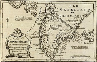
[edit]Cape Discord was named in old maps before Lieutenant Wilhelm August Graah passed it in 1829 during his East Coast expedition. Graah took a latitude observation at the headland.[2]
Geography
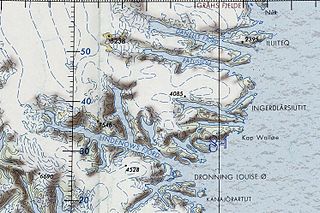
[edit]Cape Discord is located east of Danell Fjord, at the eastern end of Iluileq Island, 11 km (6.8 mi) northeast of the mouth of Paatusoq Fjord.[3] The entrance of Kangerluk Fjord is 7 km (4.3 mi) NW and that of Kuutseq Fjord 20 km (12 mi) SSW of the cape.[4]
 |
 |
References
[edit]- ^ "Den grønlandske Lods - Sejladsanvisninger Østgrønland, p. 49" (PDF). Archived from the original (PDF) on 2020-10-28. Retrieved 2019-06-02.
- ^ W. A. Graah, Narrative of an Expedition to the East Coast of Greenland, London, 1837 p. 70
- ^ Prostar Sailing Directions 2005 Greenland and Iceland Enroute, p. 100
- ^ "Kap Discord". Mapcarta. Retrieved 2 June 2019.

