California Historical Landmarks in Merced County
Appearance
From Wikipedia, the free encyclopedia
Map all coordinates using OpenStreetMap
Download coordinates as:
This list includes properties and districts listed on the California Historical Landmark listing in Merced County, California. Click the "Map of all coordinates" link to the right to view a Google map of all properties and districts with latitude and longitude coordinates in the table below.
| Image | [1] | Landmark name | Location | City or town | Summary |
|---|---|---|---|---|---|
 |
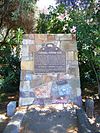
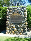
548 | Canal Farm Inn | 1460 E. Pacheco Blvd. 37°03′26″N 120°49′56″W / 37.057283°N 120.832183°W / 37.057283; -120.832183 (Canal Farm Inn) | Los Banos | |
 |
550 | Los Banos | Los Banos Park, 803 E. Pacheco Blvd. 37°03′24″N 120°50′46″W / 37.056617°N 120.846217°W / 37.056617; -120.846217 (Los Banos) | Los Banos | |
 |
934 | Merced Assembly Center | Merced County Fairgrounds 37°17′29″N 120°29′06″W / 37.2914°N 120.485039°W / 37.2914; -120.485039 (Merced Assembly Center) | Merced | |
 |
829 | Pacheco Pass | Romero Overlook 37°04′50″N 121°05′54″W / 37.080417°N 121.0982°W / 37.080417; -121.0982 (Pacheco Pass) | Los Banos | |
 |
409 | Snelling Courthouse | Main St. 37°31′10″N 120°26′15″W / 37.519547°N 120.437456°W / 37.519547; -120.437456 (Snelling Courthouse) | Snelling |
References
[edit]- ^ "California Historical Landmarks By County". Ohp.parks.ca.gov. Retrieved 2019-04-03.
See also
[edit]Wikimedia Commons has media related to California Historical Landmarks in Merced County, California.
- List of California Historical Landmarks
- National Register of Historic Places listings in Merced County, California
