Cagraray
This article needs additional citations for verification. (February 2024) |
 | |
| Geography | |
|---|---|
| Coordinates | 13°17′21″N 123°53′5″E / 13.28917°N 123.88472°E |
| Adjacent to | |
| Administration | |
| Region | Bicol Region |
| Province | Albay |
| Municipalities | |
| Demographics | |
| Population | 24,117 |
| Additional information | |
 | |

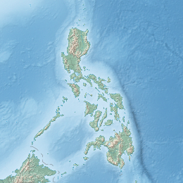
Cagraray is an island located in the province of Albay in the Philippines. Except barangays San Antonio and Salvacion which belongs to Malilipot, the other barangays of Cagraray belong to the municipality of Bacacay, Albay.
The island is sandwiched between San Miguel and Batan islands, and is home to Misibis Bay, a luxury resort.
The island is a known eco-tourism spot and is home to the Mataas cave, one of Albay's only two caves open to the public.[1] Local authorities tried to exclude it from marble mining operations in line with Republic Act 7942 or the Philippine Mining Act of 1995.[2]
Archaeological Sites
[edit]Various archaeological relics were found in the island from 1871 to 1881. Around 28 of the island's caves were also found to contain sacred burial jars.[3]
Transportation
[edit]A bridge spanning the narrowest portion of the Sula Channel connects the island to mainland Luzon. Access to the island is also available from its principal towns of Malilipot and Bacacay and from Tabaco City.
References
[edit]- ^ "'Ang Pinaka' fun-tastic things to do in Albay". GMA News Online. 16 May 2014. Retrieved 17 February 2024.
- ^ "Exclusion of Cagraray marble deposits form eco-tourism areas sought". Manila Standard. 9 July 1997. Retrieved 17 February 2024.
- ^ "$4-M windmill project to rise on Cagraray Island". The Manila Times. 17 June 2008. Retrieved 17 February 2024.
External links
[edit] Geographic data related to Cagraray at OpenStreetMap


