
Bangsal Thana
Bangsal
বংশাল | |
|---|---|
 Bangshal Road | |
 Expandable map of vicinity of Bangshal Thana | |
 Bangsal Location of Bangshal within Dhaka  Bangsal Location of Bangshal within Dhaka Division  Bangsal Location of Bangshal within Bangladesh | |
| Coordinates: 23°43′05″N 90°24′27″E / 23.71807°N 90.40747°E | |
| Country | |
| Division | Dhaka Division |
| District | Dhaka District |
| Area | |
| • Total | 1.2 km2 (0.5 sq mi) |
| Elevation | 23 m (75 ft) |
| Population (2022)[2] | |
| • Total | 176,025 |
| • Density | 155,793/km2 (403,500/sq mi) |
| Time zone | UTC+6 (BST) |
Bangsal (Bengali: বংশাল) is a Thana of Dhaka District in the Division of Dhaka, Bangladesh. It was formed in September 2009 from part of Kotwali Thana.[3]
Demographics
[edit]According to the 2011 Bangladesh census, Bangshal Thana had 35,410 households with average household size of 4.95 and a population of 186,952. Males constituted 64.39% (120,382) of the population while females 35.61% (66,570). Bangshal Thana had a literacy rate (age 7 and over) of 73.0%, compared to the national average of 51.8%, and a sex ratio of 181.There were 923 floating people in this jurisdiction. [5]
The religious breakdown was Muslim 97.18% (181,672), Hindu 2.80% (5,233), Christian 0.02% (43), Buddhist 0.00% (2), and others 0.00% (00). Only 6 ethnic people were living there.
Points of interest
[edit]- Koshaituli Mosque, built in 1919, blends pre-Mughal and Mughal architectural styles. Rectangular in plan, it has three fluted onion domes, the middle one larger than those on either side, and multifoiled or cusped arches. Decorated in 1971, it is one of the most ornate in Old Dhaka. Its entire surface is covered with mosaics made from broken bits of ceramic and glass that form geometric and floral designs and calligraphic inscriptions.[6][7]
Gallery
[edit]-
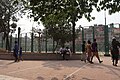 Bangladesh Math
 -
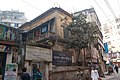 Police station in Bangshal


See also
[edit]References
[edit]- ^ "Geographic coordinates of Dhaka, Bangladesh". DATEANDTIME.INFO. Retrieved 7 July 2016.
- ^ National Report (PDF). Population and Housing Census 2022. Vol. 1. Dhaka: Bangladesh Bureau of Statistics. November 2023. p. 386. ISBN 978-9844752016.
- ^ Shamsun Nahar (2012). "Bangshal Thana". In Sirajul Islam and Ahmed A. Jamal (ed.). Banglapedia: National Encyclopedia of Bangladesh (Second ed.). Asiatic Society of Bangladesh.
- ^ "Bangladesh Population and Housing Census 2011 Zila Report – Dhaka" (PDF). bbs.gov.bd. Bangladesh Bureau of Statistics.
- ^ "Community Tables: Dhaka district" (PDF). bbs.gov.bd. 2011.
- ^ Glassie, Henry (1997). Art and Life in Bangladesh. Indiana University Press. p. 43. ISBN 978-0-253-33291-2.
- ^ Rahman, Zakia (11 August 2003). "Koshaituli Mosque: Echoing back Islamic voice". Star Heritage. The Daily Star. Archived from the original on 24 July 2015. Retrieved 26 June 2017.
This Dhaka Division location article is a stub. You can help Wikipedia by expanding it. |