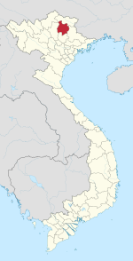
Bằng Thành
Appearance
Bằng Thành | |
|---|---|
a Rural commune (xã) | |
 | |
| Country | |
| Province | Bắc Kạn |
| District | Pác Nặm |
| Time zone | UTC+07:00 (Indochina Time) |
Bằng Thành is a rural commune (xã) of Pác Nặm District, Bắc Kạn Province, in Vietnam.
22°41′00″N 105°42′43″E / 22.68333°N 105.71194°E

