Andavite
Appearance
| Andavite | |
|---|---|
 | |
| Highest point | |
| Elevation | 5,518 m (18,104 ft) |
| Coordinates | 9°25′51″S 77°19′33″W / 9.43083°S 77.32583°W |
| Geography | |
| Location | Ancash, Peru |
| Parent range | Cordillera Blanca |
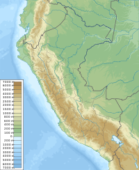
Andavite[1][2] (possibly from Quechua anta copper, p'iti dividing by pulling powerfully to the extremes; gap, interruption[3]) or Chopiraju[4] is a 5,518-metre-high (18,104 ft)[4][1] mountain in the Cordillera Blanca in the Andes of Peru. It is located northeast of the village of Pitec, between Huaraz and Huari provinces in Ancash. Andavite lies northwest of Cayesh and southeast of Tullparaju.[4] It is situated at the end of the Quilcayhuanca valley, southeast of a lake named Tullpacocha.
Sources
[edit]- ^ a b Peru 1:100 000, Huari (19-i). IGN (Instituto Geográfico Nacional - Perú).
- ^ Díaz, Felipe (2008–2009). Carta Turística. Cordilleras Blanca, Negra, Huayhuash y Callejón de Huaylas.
- ^ Teofilo Laime Ajacopa (2007). Diccionario Bilingüe: Iskay simipi yuyayk’anch: Quechua – Castellano / Castellano – Quechua (PDF). La Paz, Bolivia: futatraw.ourproject.org.
- ^ a b c Alpenvereinskarte 0/3b. Cordillera Blanca Süd (Peru). 1:100 000. Oesterreichischer Alpenverein. 2005. ISBN 3-937530-05-3.

