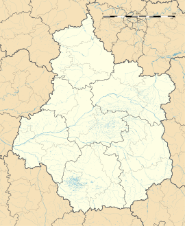
Amilly, Loiret
Appearance
Amilly | |
|---|---|
 The Briare Canal at Amilly | |
| Coordinates: 47°58′27″N 2°46′15″E / 47.9742°N 2.7708°E | |
| Country | France |
| Region | Centre-Val de Loire |
| Department | Loiret |
| Arrondissement | Montargis |
| Canton | Châlette-sur-Loing |
| Intercommunality | CA Montargoise et Rives du Loing |
| Government | |
| • Mayor (2020–2026) | Gérard Dupaty[1] |
Area 1 | 40.26 km2 (15.54 sq mi) |
| Population (2022)[2] | 13,432 |
| • Density | 330/km2 (860/sq mi) |
| Time zone | UTC+01:00 (CET) |
| • Summer (DST) | UTC+02:00 (CEST) |
| INSEE/Postal code | 45004 /45200 |
| Elevation | 86–139 m (282–456 ft) |
| 1 French Land Register data, which excludes lakes, ponds, glaciers > 1 km2 (0.386 sq mi or 247 acres) and river estuaries. | |
Amilly (French pronunciation: [amiji] or [amili]) is a commune and town in the Loiret department in north-central France.
Population
[edit]
|
| ||||||||||||||||||||||||||||||||||||||||||||||||||||||||||||||||||||||||||||||||||||||||||||||||||||||||||||||||||
| |||||||||||||||||||||||||||||||||||||||||||||||||||||||||||||||||||||||||||||||||||||||||||||||||||||||||||||||||||
| Source: EHESS[3] and INSEE (1968-2017)[4] | |||||||||||||||||||||||||||||||||||||||||||||||||||||||||||||||||||||||||||||||||||||||||||||||||||||||||||||||||||
Sights
[edit]- Church of St. Martin (16th century)
- Castles of Varenne (16th century) and of the Bourgoins (18th century)
- Bardin Watermill
- Museum of Folk Art
Twin towns
[edit]
 Nordwalde, Germany
 Vilanova del Camí, Spain
 Calcinaia, Italy
Climate
[edit]| Climate data for Amilly (1991–2020 normals, extremes 1966–present) | |||||||||||||
|---|---|---|---|---|---|---|---|---|---|---|---|---|---|
| Month | Jan | Feb | Mar | Apr | May | Jun | Jul | Aug | Sep | Oct | Nov | Dec | Year |
| Record high °C (°F) | 18.0 (64.4) |
22.0 (71.6) |
26.2 (79.2) |
31.0 (87.8) |
32.9 (91.2) |
38.7 (101.7) |
41.9 (107.4) |
42.1 (107.8) |
35.4 (95.7) |
30.6 (87.1) |
22.7 (72.9) |
18.0 (64.4) |
42.1 (107.8) |
| Mean daily maximum °C (°F) | 7.4 (45.3) |
8.9 (48.0) |
13.1 (55.6) |
16.7 (62.1) |
20.6 (69.1) |
24.2 (75.6) |
26.8 (80.2) |
26.7 (80.1) |
22.4 (72.3) |
17.2 (63.0) |
11.2 (52.2) |
7.9 (46.2) |
16.9 (62.4) |
| Daily mean °C (°F) | 4.3 (39.7) |
4.8 (40.6) |
7.9 (46.2) |
10.7 (51.3) |
14.5 (58.1) |
17.9 (64.2) |
20.0 (68.0) |
19.8 (67.6) |
16.0 (60.8) |
12.3 (54.1) |
7.6 (45.7) |
4.8 (40.6) |
11.7 (53.1) |
| Mean daily minimum °C (°F) | 1.3 (34.3) |
0.8 (33.4) |
2.7 (36.9) |
4.6 (40.3) |
8.4 (47.1) |
11.7 (53.1) |
13.3 (55.9) |
12.9 (55.2) |
9.6 (49.3) |
7.4 (45.3) |
3.9 (39.0) |
1.8 (35.2) |
6.5 (43.7) |
| Record low °C (°F) | −21.0 (−5.8) |
−22.0 (−7.6) |
−13.0 (8.6) |
−6.3 (20.7) |
−1.0 (30.2) |
0.1 (32.2) |
3.9 (39.0) |
2.4 (36.3) |
−1.0 (30.2) |
−7.8 (18.0) |
−11.2 (11.8) |
−17.2 (1.0) |
−22.0 (−7.6) |
| Average precipitation mm (inches) | 46.7 (1.84) |
44.3 (1.74) |
44.1 (1.74) |
50.6 (1.99) |
66.1 (2.60) |
51.5 (2.03) |
56.4 (2.22) |
49.9 (1.96) |
48.5 (1.91) |
62.0 (2.44) |
61.7 (2.43) |
61.0 (2.40) |
642.8 (25.31) |
| Average precipitation days (≥ 1.0 mm) | 10.3 | 10.3 | 9.1 | 9.1 | 9.6 | 8.2 | 7.8 | 7.2 | 7.8 | 10.3 | 10.9 | 12.3 | 112.9 |
| Source: Meteociel[5] | |||||||||||||
References
[edit]- ^ "Répertoire national des élus: les maires". data.gouv.fr, Plateforme ouverte des données publiques françaises (in French). 2 December 2020.
- ^ "Populations de référence 2022" (in French). The National Institute of Statistics and Economic Studies. 19 December 2024.
- ^ Des villages de Cassini aux communes d'aujourd'hui: Commune data sheet Amilly, EHESS (in French).
- ^ Population en historique depuis 1968, INSEE
- ^ "Normales et records pour Amilly (45)". Meteociel. Retrieved 21 November 2024.
External links
[edit]Wikimedia Commons has media related to Amilly (Loiret).


