Alas Administrative Post
Alas | |
|---|---|
| |
 Swampland and tall grassland, Clere River area, Welaluhu, Manufahi | |
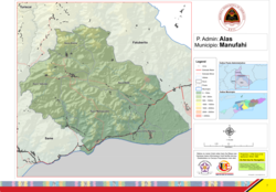
 Official map | |
| Coordinates: 9°1′S 125°48′E / 9.017°S 125.800°E | |
| Country | |
| Municipality | Manufahi |
| Seat | Mahaquidan |
| Sucos | |
| Area | |
• Total | 406.4 km2 (156.9 sq mi) |
| Population (2015 census) | |
• Total | 7,884 |
| • Density | 19/km2 (50/sq mi) |
| Households (2015 census) | |
| • Total | 1,405 |
| Time zone | UTC+09:00 (TLT) |
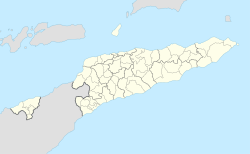
Alas, officially Alas Administrative Post (Portuguese: Posto Administrativo de Alas, Tetum: Postu administrativu Alas), is an administrative post (and was formerly a subdistrict) in the centre of Manufahi municipality, which lies in the centre of East Timor.[1][2] Its seat or administrative centre is Mahaquidan,[2] and it is divided into five sucos: Aituha, Dotik (Dotic), Mahaquidan, Taitudac und Uma Berloic (Uma Berloik).
The South Laclo, the largest river in Manufahi, flows across the Alas plain and into the Timor Sea. In the centre of Alas, to the East of Alas town, the river is joined by a tributary and forms a large lake with many islands. The Clerec river forms a border to the East, where the administrative post of Alas meets the administrative post of Fatuberlio. Fatuberlio then continues on, past Alas, to the North. Shortly before the river mouth, the Clerec forms a lagoon known as the Lagoa Mapliu. A number of further lagoons are to be found on both sides of the Lacló and Clerec estuaries. The most southerly point of Alas, Ponta Metibot[3] is located some distance East of the Quelan estuary, to the West of Same administrative post.
Demographics
[edit]The population of Alas Administrative Post as of the 2010 census was 7,179,[4] rising from 6,485 in 2004.[5] The average age among inhabitants was 17.4 years [6]
The most commonly spoken language is Tetum Terik, a dialect of Tetum.
49% of households in Alas grow cassava, 51% grow corn, 48% grow assorted vegetables, 43% grow rice and 27% grow coffee. 53% of households own coconut palm trees.
References
[edit]- ^ "Subdistricts of Timor-Leste". www.statoids.com. 4 May 2010. Retrieved 21 September 2022.
- ^ a b "Diploma Ministerial n.o 24/2014 de 24 de Julho Orgânica dos Postos Administrativos Preâmbulo" [Ministerial Diploma No. 24/2014 of 24 July Organic of Administrative Posts Preamble]. Jornal da República (in Portuguese). Government of East Timor. 24 July 2014. Archived from the original on 4 March 2016. Retrieved 21 September 2022.
- ^ UNMIT map from August 2008 Archived 2011-12-03 at the Wayback Machine (PDF; 523 kB)
- ^ "Archived copy" (PDF). dne.mof.gov.tl. Archived from the original (PDF) on 12 August 2011. Retrieved 13 January 2022.
{{cite web}}: CS1 maint: archived copy as title (link) - ^ "Direcção Nacional de Estatística". Archived from the original on 29 September 2007. Retrieved 26 January 2011.
- ^ Direcção Nacional de Estatística Census 2004 Archived 2007-09-29 at the Wayback Machine
External links
[edit]![]() Media related to Alas Administrative Post at Wikimedia Commons
Media related to Alas Administrative Post at Wikimedia Commons
- Alas Administrative Post – information page on Ministry of State Administration site (in Portuguese)

