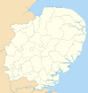
Uttlesford
Uttlesford District | |
|---|---|
 Uttlesford shown within Essex | |
| Sovereign state | United Kingdom |
| Constituent country | England |
| Region | East of England |
| Non-metropolitan county | Essex |
| Status | Non-metropolitan district |
| Admin HQ | Saffron Walden |
| Incorporated | 1 April 1974 |
| Government | |
| • Type | Non-metropolitan district council |
| • Body | Uttlesford District Council |
| • Leadership | Alternative - Sec. 31 (Independent) |
| • MPs | Alan Haselhurst |
| Area | |
• Total | 247.56 sq mi (641.18 km2) |
| • Rank | 54th (of 296) |
| Population (2022) | |
• Total | 92,578 |
| • Rank | 259th (of 296) |
| • Density | 370/sq mi (140/km2) |
| • Ethnicity | 95.4% White 1.6% S.Asian 1.1% Black 1.1% Mixed Race 0.9% Chinese or Other |
| Time zone | UTC0 (GMT) |
| • Summer (DST) | UTC+1 (BST) |
| ONS code | 22UQ (ONS) E07000077 (GSS) |
| OS grid reference | TL541387 |
| Website | www |
Uttlesford is a local government district in Essex, England. Its council is based in Saffron Walden.
Its name is derived from the ancient Hundred of the same name.
The district was formed on 1 April 1974 by the merger of the borough of Saffron Walden, Dunmow Rural District and Saffron Walden Rural District.
In 2001, Uttlesford was voted as the best place to live in England, in a survey by the Sunday Times newspaper. A range of factors, including housing costs, quality of schools, and low crime contributed to the overall result.[citation needed]
Uttlesford District includes Stansted Airport, which is its major employer.
Uttlesford has recently been found to be the healthiest place to live in the UK, due to the relatively low level of obesity problems in the area.[citation needed]
Energy policy
In May 2006, a report commissioned by British Gas[1] showed that housing in Uttlesford produced the highest average carbon emissions in the country at 8,092 kg of carbon dioxide per dwelling.[2] In response the council stated We try and lead by example but there is nothing else we can do to get people to save energy.[3]
The council has, however, introduced a planning permission condition requiring certain energy conservation measures to be taken when homes are extended,[4] and has a number of other initiatives.[5]
A recent study by the consultancy Altechnica indicated that all of Uttlesford's energy could come from renewable sources.[6]
Economy
Titan Airways has its head office in the Enterprise House on the grounds of London Stansted Airport in Stansted Mountfitchet, Uttlesford.[7]
In the past, several airlines, including Buzz,[8] AirUK (later KLM uk),[9][10] AB Airlines,[11] Go Fly, Go Fly had its head office at the Enterprise House.[12] and Lloyd International Airways had their head offices on the property of Stansted Airport.[13]
See also
References
- ^ http://www.britishgasnews.co.uk/managed_content/files/pdf/greenCity.pdf britishsgasnews.co.uk
- ^ http://news.independent.co.uk/environment/article570194.ece news.independent.co.uk
- ^ http://environment.guardian.co.uk/climatechange/story/0,,1829050,00.html environment.guardian.co.uk
- ^ http://www.uttlesford.gov.uk/main.cfm?Type=CCEE&MenuId=361 uttlesford.gov.uk
- ^ http://www.uttlesford.gov.uk/main.cfm?Type=CC&MenuId=184 uttlesford.gov.uk
- ^ Uttlesford could get all its energy from renewable sources
- ^ "Contact Us." Titan Airways. Retrieved on 16 December 2011. "Titan Airways Ltd Enterprise House Stansted Airport Essex CM24 1RN"
- ^ "Contact Us." Buzz. Retrieved on 2 September 2009.
- ^ "Home-page." [sic] AirUK. Retrieved on 28 February 2010.
- ^ "World Airline Directory." Flight International. 18–24 March 1998. 82.
- ^ "An Introduction to AB Airlines." AB Airlines. 30 January 1998. Retrieved on 7 February 2011. "AB Airlines - Internet Enquiry Office Enterprise House, Stansted Airport Essex. CM24 1QW"
- ^ "World Airline Directory." Flight International. 27 March-2 April 2001. 77. "Enterprise House, 2nd Floor, Stansted Airport, Stansted, Essex, CM241SB, UK"
- ^ "World Airline Directory." Flight International. 10 April 1969. 580. "Head Office: Lloyd House, First Avenue, Stansted Airport, Essex."

