1967 Pacific typhoon season
| 1967 Pacific typhoon season | |
|---|---|
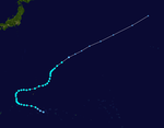
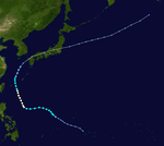
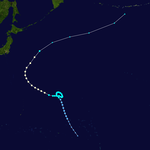
 Season summary map | |
| Seasonal boundaries | |
| First system formed | January 28, 1967 |
| Last system dissipated | December 21, 1967 |
| Strongest storm | |
| Name | Carla |
| • Maximum winds | 295 km/h (185 mph) (1-minute sustained) |
| • Lowest pressure | 900 hPa (mbar) |
| Seasonal statistics | |
| Total depressions | 40 |
| Total storms | 35 |
| Typhoons | 20 |
| Super typhoons | 5 (unofficial) |
| Total fatalities | 934 |
| Total damage | Unknown |
| Related articles | |
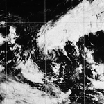
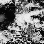
The 1967 Pacific typhoon season was one of the most active Pacific typhoon seasons on record, witnessing the formation of 35 tropical storms during the season. It began on January 1, 1967, though most storms usually form between June and December within the basin. The first storm of the season, Ruby, formed on January 28 west of the Philippines. The scope of this article is limited to the Pacific Ocean, north of the equator and west of the International Date Line. Storms that form east of the date line and north of the equator are called hurricanes; see 1967 Pacific hurricane season. Tropical depressions that are monitored by the United States' Joint Typhoon Warning Center (JTWC) were given a numerical designation with a "W" suffix, and any storms reaching 1-minute sustained winds of over 40 mph were given a name. Tropical depressions that enter or form in the Philippine area of responsibility are assigned a name by the Philippine Atmospheric, Geophysical and Astronomical Services Administration or PAGASA. This can often result in the same storm having two names.
In 1967, the number of storms that the Japan Meteorological Agency considered "typhoons" was the record number (39).[1] However, the JTWC only considers 35 storms to have formed during the season, beginning with Ruby in January. Out of those 35 storms, 20 intensified to category 1-equivalent typhoons, 5 of those further strengthening to super typhoons.
Systems
[edit]
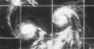
During the 1967 Pacific typhoon season, 40 tropical depressions formed, of which 35 became tropical storms. Twenty tropical storms attained typhoon intensity, and five of the typhoons reached super typhoon intensity.
Tropical Storm Ruby (Auring)
[edit]| Tropical storm (JMA) | |
| Tropical storm (SSHWS) | |
| Duration | January 28 – February 6 |
|---|---|
| Peak intensity | 75 km/h (45 mph) (1-min); 996 hPa (mbar) |
Tropical Depression 01W formed on January 28, well to the south of Sorol Atoll in the Caroline Islands. It was later named Auring by PAGASA, but it did not strengthen to a tropical storm until February 5, being named Ruby by the JTWC. Ruby dissipated four days later on February 9, southeast of the Davao region of the Philippines.
Typhoon Sally (Bebeng)
[edit]| Typhoon (JMA) | |
| Category 2-equivalent typhoon (SSHWS) | |
| Duration | February 28 – March 7 |
|---|---|
| Peak intensity | 155 km/h (100 mph) (1-min); 980 hPa (mbar) |
Sally originated from an area of low pressure that formed northeast of Manus Island in Papua New Guinea.
Severe Tropical Storm Therese
[edit]| Severe tropical storm (JMA) | |
| Tropical storm (SSHWS) | |
| Duration | March 15 – March 24 |
|---|---|
| Peak intensity | 110 km/h (70 mph) (1-min); 990 hPa (mbar) |
This section is empty. You can help by adding to it. (September 2024) |
Typhoon Violet (Karing)
[edit]| Typhoon (JMA) | |
| Category 4-equivalent typhoon (SSHWS) | |
| Duration | March 31 – April 12 |
|---|---|
| Peak intensity | 220 km/h (140 mph) (1-min); 930 hPa (mbar) |
Typhoon Violet, which formed on April 1, steadily weakened from its peak of 140 mph to directly impact northeastern Luzon as a 115 mph typhoon on the 8th. It dissipated in the South China Sea on April 12 without causing any significant damage.
Tropical Storm Wilda (Diding)
[edit]| Tropical storm (JMA) | |
| Tropical storm (SSHWS) | |
| Duration | May 8 – May 13 |
|---|---|
| Peak intensity | 75 km/h (45 mph) (1-min); 1004 hPa (mbar) |
This section is empty. You can help by adding to it. (September 2024) |
Typhoon Anita (Gening)
[edit]| Typhoon (JMA) | |
| Category 1-equivalent typhoon (SSHWS) | |
| Duration | June 24 – July 1 |
|---|---|
| Peak intensity | 150 km/h (90 mph) (1-min); 975 hPa (mbar) |
Anita caused a plane crash in Hong Kong.
Typhoon Billie (Herming)
[edit]| Typhoon (JMA) | |
| Category 1-equivalent typhoon (SSHWS) | |
| Duration | June 29 – July 8 |
|---|---|
| Peak intensity | 140 km/h (85 mph) (1-min); 980 hPa (mbar) |
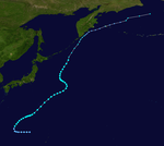
Typhoon Billie, having developed on July 2, reached its peak of 85 mph on July 5. Billie's intensity fluctuated as it headed northward to Japan, and it became extratropical on the 8th; however, Billie's extratropical remnant continued northeastward, and it brought heavy rain to Honshū and Kyūshū, killing 347 people.
Typhoon Clara (Ising)
[edit]| Typhoon (JMA) | |
| Category 3-equivalent typhoon (SSHWS) | |
| Duration | July 2 – July 12 |
|---|---|
| Peak intensity | 185 km/h (115 mph) (1-min); 960 hPa (mbar) |
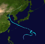
A cold core low developed tropical characteristics and became Tropical Depression 8W on July 6. It tracked westward, becoming a tropical storm later that day and a typhoon on July 7. After briefly weakening to a tropical storm, Clara re-attained typhoon status, and it peaked in intensity on July 10, reaching winds of 115 mph. Clara weakened to a 90 mph typhoon just before hitting Taiwan on the 11th, and it dissipated over China the next day. Clara's heavy rains caused 69 fatalities and a further 32 people to be reported as missing.
Typhoon Dot
[edit]| Typhoon (JMA) | |
| Tropical storm (SSHWS) | |
| Duration | July 19 – July 29 |
|---|---|
| Peak intensity | 110 km/h (70 mph) (1-min); 975 hPa (mbar) |
This section is empty. You can help by adding to it. (September 2024) |
Typhoon Ellen
[edit]| Typhoon (JMA) | |
| Category 1-equivalent typhoon (SSHWS) | |
| Duration | July 27 – August 4 |
|---|---|
| Peak intensity | 150 km/h (90 mph) (1-min); 970 hPa (mbar) |
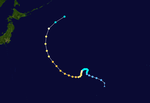
On July 24, the remnants of Tropical Storm Eleanor had crossed over the International Date Line began to stabilize and re-formed into Typhoon Ellen.
Severe Tropical Storm Fran (Mameng)
[edit]| Severe tropical storm (JMA) | |
| Tropical storm (SSHWS) | |
| Duration | July 28 – August 3 |
|---|---|
| Peak intensity | 110 km/h (70 mph) (1-min); 975 hPa (mbar) |
This section is empty. You can help by adding to it. (September 2024) |
Severe Tropical Storm Georgia (Luding)
[edit]| Severe tropical storm (JMA) | |
| Tropical storm (SSHWS) | |
| Duration | July 28 – August 8 |
|---|---|
| Peak intensity | 110 km/h (70 mph) (1-min); 982 hPa (mbar) |
This section is empty. You can help by adding to it. (September 2024) |
Severe Tropical Storm Hope
[edit]| Severe tropical storm (JMA) | |
| Tropical storm (SSHWS) | |
| Duration | August 3 – August 11 |
|---|---|
| Peak intensity | 110 km/h (70 mph) (1-min); 984 hPa (mbar) |
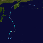
The remnants of Tropical Storm Hope contributed to an atmospheric river oriented towards Interior Alaska that caused the 1967 Fairbanks flood, the worst and most damaging flooding in Fairbanks' history.[2]
Tropical Depression Neneng
[edit]| Tropical depression (PAGASA) | |
| Duration | August 5 – August 8 |
|---|---|
| Peak intensity | 55 km/h (35 mph) (10-min); 999 hPa (mbar) |
This section is empty. You can help by adding to it. (September 2024) |
Tropical Depression 16W
[edit]| Tropical depression (JMA) | |
| Tropical depression (SSHWS) | |
| Duration | August 9 – August 11 |
|---|---|
| Peak intensity | 55 km/h (35 mph) (1-min); 995 hPa (mbar) |
This section is empty. You can help by adding to it. (September 2024) |
Tropical Storm 17W
[edit]| Tropical storm (JMA) | |
| Tropical storm (SSHWS) | |
| Duration | August 9 – August 13 |
|---|---|
| Peak intensity | 95 km/h (60 mph) (1-min); 988 hPa (mbar) |
This section is empty. You can help by adding to it. (September 2024) |
Tropical Storm Iris (Oniang)
[edit]| Tropical storm (JMA) | |
| Tropical storm (SSHWS) | |
| Duration | August 10 – August 18 |
|---|---|
| Peak intensity | 75 km/h (45 mph) (1-min); 994 hPa (mbar) |
Severe Tropical Storm Louise
[edit]| Severe tropical storm (JMA) | |
| Tropical storm (SSHWS) | |
| Duration | August 15 – August 24 |
|---|---|
| Peak intensity | 100 km/h (65 mph) (1-min); 980 hPa (mbar) |
Severe Tropical Storm Joan
[edit]| Severe tropical storm (JMA) | |
| Tropical storm (SSHWS) | |
| Duration | August 16 – August 25 |
|---|---|
| Peak intensity | 100 km/h (65 mph) (1-min); 988 hPa (mbar) |
Typhoon Kate (Pepang)
[edit]| Typhoon (JMA) | |
| Category 1-equivalent typhoon (SSHWS) | |
| Duration | August 16 – August 24 |
|---|---|
| Peak intensity | 130 km/h (80 mph) (1-min); 982 hPa (mbar) |
Typhoon Marge (Rosing)
[edit]| Typhoon (JMA) | |
| Category 4-equivalent typhoon (SSHWS) | |
| Duration | August 23 – August 30 |
|---|---|
| Peak intensity | 230 km/h (145 mph) (1-min); 940 hPa (mbar) |
Tropical Depression 23W
[edit]| Tropical depression (JMA) | |
| Tropical depression (SSHWS) | |
| Duration | August 25 – August 26 |
|---|---|
| Peak intensity | 45 km/h (30 mph) (1-min); 998 hPa (mbar) |
Typhoon Nora (Sisang)
[edit]| Typhoon (JMA) | |
| Category 1-equivalent typhoon (SSHWS) | |
| Duration | August 25 – September 1 |
|---|---|
| Peak intensity | 130 km/h (80 mph) (1-min); 990 hPa (mbar) |
Super Typhoon Opal
[edit]| Typhoon (JMA) | |
| Category 5-equivalent super typhoon (SSHWS) | |
| Duration | August 29 – September 17 |
|---|---|
| Peak intensity | 285 km/h (180 mph) (1-min); 920 hPa (mbar) |
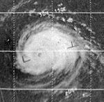
Super Typhoon Opal was a powerful system that peaked in winds of 180 miles per hour (mph), the equivalent of a Category 5 hurricane.
Tropical Storm Patsy
[edit]| Tropical storm (JMA) | |
| Tropical storm (SSHWS) | |
| Duration | September 3 – September 7 |
|---|---|
| Peak intensity | 95 km/h (60 mph) (1-min); 995 hPa (mbar) |
Typhoon Ruth
[edit]| Typhoon (JMA) | |
| Category 3-equivalent typhoon (SSHWS) | |
| Duration | September 5 – September 14 |
|---|---|
| Peak intensity | 205 km/h (125 mph) (1-min); 940 hPa (mbar) |
Tropical Storm Thelma
[edit]| Tropical storm (JMA) | |
| Tropical storm (SSHWS) | |
| Duration | September 10 – September 12 |
|---|---|
| Peak intensity | 95 km/h (60 mph) (1-min); 990 hPa (mbar) |
Severe Tropical Storm Vera
[edit]| Severe tropical storm (JMA) | |
| Tropical storm (SSHWS) | |
| Duration | September 12 – September 16 |
|---|---|
| Peak intensity | 85 km/h (50 mph) (1-min); 994 hPa (mbar) |
Super Typhoon Sarah
[edit]| Typhoon (JMA) | |
| Category 4-equivalent typhoon (SSHWS) | |
| Duration | September 14 (Entered Basin) – September 22 |
|---|---|
| Peak intensity | 240 km/h (150 mph) (1-min); 930 hPa (mbar) |
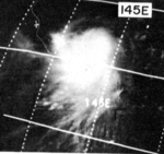
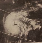
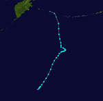
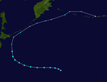
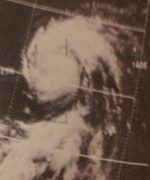
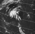
On September 14, Hurricane Sarah, which formed across the International Date Line, entered the Western Pacific. Immediately after the first advisory following Sarah's entrance into the West Pacific, it was upgraded to a minimal typhoon. Typhoon Sarah continued to intensify, and late on September 15, it was upgraded to a Category 4 typhoon. The next day, Sarah reached its peak intensity, attaining 150 mph winds and a 932 millibar (mbar) pressure reading (this was the only pressure measurement retrieved from the typhoon), making the system a super typhoon. Sarah began gradually weakening afterwards, and late on September 21, it became extratropical; it was still an 80 mph Category 1 typhoon at the time.
On September 16, Sarah made landfall on Wake Island at peak intensity, causing widespread damage. This typhoon was the third tropical cyclone since the beginning of observations in 1935 to bring typhoon-force winds to Wake Island, following an unnamed typhoon which struck on October 19, 1940 (Tomita, 1968), which brought 120 knot winds to the island, and Typhoon Olive in 1952, which lashed the island with 150 knot winds.[3]
Typhoon Wanda
[edit]| Typhoon (JMA) | |
| Category 2-equivalent typhoon (SSHWS) | |
| Duration | September 16 – September 24 |
|---|---|
| Peak intensity | 175 km/h (110 mph) (1-min); 962 hPa (mbar) |
JMA Tropical Storm Twenty-nine
[edit]| Tropical storm (SSHWS) | |
| Duration | September 16 – September 18 |
|---|---|
| Peak intensity | 95 km/h (60 mph) (1-min); 998 hPa (mbar) |
Typhoon Amy
[edit]| Typhoon (JMA) | |
| Category 1-equivalent typhoon (SSHWS) | |
| Duration | September 24 – October 6 |
|---|---|
| Peak intensity | 150 km/h (90 mph) (1-min); 962 hPa (mbar) |
JMA Tropical Storm Thirty-one
[edit]| Tropical storm (SSHWS) | |
| Duration | September 28 – October 1 |
|---|---|
| Peak intensity | 95 km/h (60 mph) (1-min); 992 hPa (mbar) |
Tropical Depression 34W
[edit]| Tropical depression (JMA) | |
| Tropical depression (SSHWS) | |
| Duration | October 6 – October 9 |
|---|---|
| Peak intensity | 55 km/h (35 mph) (1-min); 1004 hPa (mbar) |
Severe Tropical Storm Babe
[edit]| Severe tropical storm (JMA) | |
| Tropical storm (SSHWS) | |
| Duration | October 6 – October 10 |
|---|---|
| Peak intensity | 110 km/h (70 mph) (1-min); 980 hPa (mbar) |
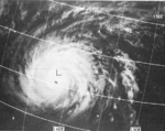
Super Typhoon Carla (Trining)
[edit]| Typhoon (JMA) | |
| Category 5-equivalent super typhoon (SSHWS) | |
| Duration | October 10 – October 20 |
|---|---|
| Peak intensity | 295 km/h (185 mph) (1-min); 900 hPa (mbar) |
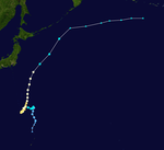
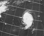
Carla became an intense typhoon while located in the Philippine Sea on October 15.[4] During its weakening stage, the typhoon dumped extreme rainfall around its circulation. Baguio, Philippines recorded 47.86 inches (1,216 mm) of rainfall in a 24‑hour period between October 17 and October 18; however, Carla's precipitation was significantly more extreme in Taiwan, where 108.21 inches (2,749 mm) fell in a 48‑hour period between October 17 and October 19.[5] The worst typhoon to hit the country during the year, it killed 250 people and left 30 others missing.
Typhoon Dinah (Uring)
[edit]| Typhoon (JMA) | |
| Category 3-equivalent typhoon (SSHWS) | |
| Duration | October 16 – October 27 |
|---|---|
| Peak intensity | 185 km/h (115 mph) (1-min); 950 hPa (mbar) |
Typhoon Dinah struck the southern island of Kyūshū in Japan, killing thirty-seven people and resulting in ten others being reported as missing.[6]
Super Typhoon Emma (Welming)
[edit]| Typhoon (JMA) | |
| Category 5-equivalent super typhoon (SSHWS) | |
| Duration | October 31 – November 8 |
|---|---|
| Peak intensity | 260 km/h (160 mph) (1-min); 908 hPa (mbar) |
Typhoon Emma was the second super Typhoon to hit the Philippines just 2 weeks after Typhoon Carla. Typhoon Emma left 300 people dead and 60 others missing.
Typhoon Freda (Yayang)
[edit]| Typhoon (JMA) | |
| Category 2-equivalent typhoon (SSHWS) | |
| Duration | November 6 – November 11 |
|---|---|
| Peak intensity | 155 km/h (100 mph) (1-min); 972 hPa (mbar) |
Super Typhoon Gilda (Ading)
[edit]| Typhoon (JMA) | |
| Category 4-equivalent typhoon (SSHWS) | |
| Duration | November 7 – November 19 |
|---|---|
| Peak intensity | 240 km/h (150 mph) (1-min); 910 hPa (mbar) |
Typhoon Harriet
[edit]| Typhoon (JMA) | |
| Category 3-equivalent typhoon (SSHWS) | |
| Duration | November 15 – November 24 |
|---|---|
| Peak intensity | 205 km/h (125 mph) (1-min); 950 hPa (mbar) |
Severe Tropical Storm Ivy (Barang)
[edit]| Severe tropical storm (JMA) | |
| Tropical storm (SSHWS) | |
| Duration | December 16 – December 21 |
|---|---|
| Peak intensity | 110 km/h (70 mph) (1-min); 980 hPa (mbar) |
Storm names
[edit]International
[edit]
|
|
|
|
Philippines
[edit]| Auring | Bebeng | Karing | Diding | Etang |
| Gening | Herming | Ising | Luding | Mameng |
| Neneng | Oniang | Pepang | Rosing | Sisang |
| Trining | Uring | Welming | Yayang | |
| Auxiliary list | ||||
|---|---|---|---|---|
| Ading | ||||
| Barang | Krising (unused) | Dadang (unused) | Erling (unused) | Goying (unused) |
The Philippine Atmospheric, Geophysical and Astronomical Services Administration uses its own naming scheme for tropical cyclones in their area of responsibility. PAGASA assigns names to tropical depressions that form within their area of responsibility and any tropical cyclone that might move into their area of responsibility. Should the list of names for a given year prove to be insufficient, names are taken from an auxiliary list, the first 6 of which are published each year before the season starts. The names not retired from this list will be used again in the 1971 season. This is the same list used for the 1963 season. The names Uring, Welming, Yayang, Ading and Barang used the first time (and only, in the case of Welming). PAGASA uses its own naming scheme that starts in the Filipino alphabet, with names of Filipino female names ending with "ng" (A, B, K, D, etc.). Names that were not assigned/going to use are marked in gray.
Retirement
[edit]Due to an extreme death toll caused by Typhoon Emma (Welming) in the Philippines, PAGASA later retired the name Welming and was replaced by Warling for the 1971 season.
See also
[edit]- 1967 Atlantic hurricane season
- 1967 Pacific hurricane season
- List of wettest tropical cyclones
- Australian cyclone seasons: 1966–67, 1967–68
- South Pacific cyclone seasons: 1966–67, 1967–68
- South-West Indian Ocean cyclone seasons: 1966–67, 1967–68
References
[edit]- ^ "発生数". www.data.jma.go.jp. 気象庁. Retrieved 2022-11-18.
- ^ Childers, J.M.; Meckel, J.P.; Anderson, G.S. (1972). Floods of August 1967 in East-Central Alaska (PDF) (Report). United States Printing Office. Retrieved 21 July 2024.
- ^ "1967 Central Pacific Tropical Cyclone season".
- ^ Kitamoto Asanobu (2012). "Digital Typhoon: Typhoon 196733 (CARLA) - General Information (Pressure and Track Charts)". Retrieved 2012-02-23.
- ^ J. L. H. Paulhaus (1973). World Meteorological Organization Operational Hydrology Report No. 1: Manual For Estimation of Probable Maximum Precipitation. World Meteorological Organization. p. 178.
- ^ Digital Typhoon: Disaster Information
External links
[edit]- Japan Meteorological Agency
- Joint Typhoon Warning Center Archived 2010-03-01 at the Wayback Machine.
- China Meteorological Agency
- National Weather Service Guam
- Hong Kong Observatory
- Macau Meteorological Geophysical Services
- Korea Meteorological Agency
- Philippine Atmospheric, Geophysical and Astronomical Services Administration
- Taiwan Central Weather Bureau
- Digital Typhoon - Typhoon Images and Information
- Typhoon2000 Philippine typhoon website

