Ōkiritoto Stream
| Ōkiritoto Stream Muriwai Stream | |
|---|---|
 The Ōkiritoto Stream in 2009 | |
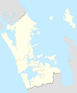
 Route of the Ōkiritoto Stream | |
| Native name | Waimanu Awa |
| Location | |
| Country | New Zealand |
| Region | Auckland Region |
| Physical characteristics | |
| Source | Muriwai |
| • coordinates | 36°49′22″S 174°26′38″E / 36.8227°S 174.444°E |
| Mouth | Tasman Sea |
• coordinates | 36°48′26″S 174°24′44″E / 36.8071°S 174.4121°E |
| Basin features | |
| Progression | Ōkiritoto Stream → Tasman Sea |
| Landmarks | Muriwai |
| Tributaries | |
| • right | Raurataua Stream |
| Waterfalls | Ōkiritoto Falls, Toroanui Falls |
Ōkiritoto Stream, also known as the Muriwai Stream, is a stream of the Auckland Region of New Zealand's North Island. The stream originates to the east of Muriwai township, and flows in a circular anti-clockwise direction, flowing into Muriwai Beach at Muriwai Regional Park north of the Muriwai Golf Course. The stream is home to two waterfalls, the Okiritoto Falls and the Toroanui Falls.
Geography
[edit]The stream begins at a point to the east of Muriwai township near Coster Road, flowing northeast into rural Rodney District, where is meets the Rauratawa Stream. At this point the stream begins to flow westwards, flowing towards Muriwai Beach.[1] Along this strip are two waterfalls, the Ōkiritoto Falls,[2] and the Toroanui Falls.[3] The lower Ōkiritoto Stream becomes a wetland, reaching Muriwai Beach just to the north of the Muriwai Golf Course.[4]
History
[edit]The stream was traditionally known by Te Kawerau ā Maki as Waimanu, and was used as a location for hauling waka by the occupants of Te Muriwai, a kāinga located on the stream.[5] The name of the village eventually was adopted as the name for the river valley, and eventually for the wider Muriwai area.[6] The area surrounding the mouth of the stream was traditionally known as Paengatohora, a name referencing the numerous whale strandings which have occurred here.[7]
After peace was forged between Te Kawerau ā Maki and Te Taoū (Ngāti Whātua) in the 18th century, a peace marriage was formed between Te Waitaheke, a rangatira of Te Taoū, and Te Kahupara, a high ranking woman of Te Kawerau ā Maki. Their union led to the creation of the hapū Ngāti Te Kahupara, a group who had ties to both Ngāti Whātua and Te Kawerau ā Maki. Ngāti Te Kahupara's settlement focused in the Muriwai area, and a kāinga (village) called Oneonenui was constructed near the Ōkiritoto Falls.[8] The stream was likely used by Tāmaki Māori to harvest flax and collect freshwater fish and shellfish species such as eels, īnanga, kōkopu and kākahi.[4]
In 1870, John and Annie Foster established a flax mill on the southern bank of the Ōkiritoto Stream near the Ōkiritoto Falls. Flax from throughout the Muriwai area was processed here, until the mill was destroyed in a fire.[4] In 1912 a guesthouse was established at Muriwai Beach, and guests would often enjoy recreational activities around the Ōkiritoto Stream.[4]
Numerous whale strandings have occurred near the stream mouth in the late 19th and early 20th centuries.[7]
In 2009, a waka made from kauri wood was discovered in the stream.[9]
See also
[edit]References
[edit]- ^ "Place name detail: Ōkiritoto Stream". New Zealand Gazetteer. Land Information New Zealand. Retrieved 14 June 2024.
- ^ "Place name detail: Ōkiritoto Falls". New Zealand Gazetteer. Land Information New Zealand. Retrieved 14 June 2024.
- ^ "Place name detail: Toroanui Falls". New Zealand Gazetteer. Land Information New Zealand. Retrieved 14 June 2024.
- ^ a b c d Campbell, Matthew; Glover, Hayley; Craig, Jacqueline; Brown, John (9 December 2021). Muriwai Downs Golf Project: archaeological assessment (PDF) (Report). CFG Heritage. Retrieved 14 June 2024.
- ^ Te Kawerau ā Maki; The Trustees of Te Kawerau Iwi Settlement Trust; The Crown (22 February 2014). "Te Kawerau ā Maki Deed of Settlement Schedule" (PDF). Archived (PDF) from the original on 15 November 2021. Retrieved 10 May 2022.
- ^ Cameron, Ewen; Hayward, Bruce; Murdoch, Graeme (2008). A Field Guide to Auckland: Exploring the Region's Natural and Historical Heritage (rev. ed.). Random House New Zealand. pp. 156–157. ISBN 978-1-86962-1513.
- ^ a b Harvey, Bob (2012). Untamed Coast: Auckland's Waitakere Ranges and Heritage Area (revised and updated ed.). Auckland: Exisle Publishing. p. 192. ISBN 978-0-908988-67-9.
- ^ History of Human Occupation and Archaeology of Muriwai Regional Park (Report). Auckland Regional Council. 1994. p. 59.
- ^ Boswijk, Gretel; Johns, Dilys (1 February 2018). "Assessing the potential to calendar date Māori waka (canoes) using dendrochronology". Journal of Archaeological Science: Reports. 17: 442–448. doi:10.1016/j.jasrep.2017.11.030. hdl:2292/42468. ISSN 2352-409X.


