
Tompkins County, New York
Tompkins County | |
|---|---|
 Seal | |
 Location within the U.S. state of New York | |
 New York's location within the U.S. | |
| Coordinates: 42°27′N 76°28′W / 42.45°N 76.47°W | |
| Country | |
| State | |
| Founded | 1817 |
| Seat | Ithaca |
| Area | |
| • Total | 476 sq mi (1,230 km2) |
| • Land | 460 sq mi (1,200 km2) |
| • Water | 16 sq mi (40 km2) 3.17% |
| Population (2000) | |
| • Total | 96,501 |
| • Density | 200/sq mi (78/km2) |
| Website | www |
Tompkins County is a county located in the U.S. state of New York, and comprises the whole of the Ithaca metropolitan area. As of the 2000 census, the population was 96,501. The county seat is Ithaca, and is home to Cornell University, Ithaca College and nearby Wells College. The name is in honor of Daniel D. Tompkins, who served as Governor of New York and Vice President of the United States of America.
History
When counties were established in New York State in 1683, the present Tompkins County was part of Albany County. This was an enormous county, including the northern part of New York State as well as all of the present State of Vermont and, in theory, extending westward to the Pacific Ocean. This county was reduced in size on July 3, 1766 by the creation of Cumberland County, and further on March 16, 1770 by the creation of Gloucester County, both containing territory now in Vermont.
On March 12, 1772, what was left of Albany County was split into three parts, one remaining under the name Albany County. One of the other pieces, Tryon County, contained the western portion (and thus, since no western boundary was specified, theoretically still extended west to the Pacific). The eastern boundary of Tryon County was approximately five miles west of the present city of Schenectady, and the county included the western part of the Adirondack Mountains and the area west of the West Branch of the Delaware River. The area then designated as Tryon County now includes 37 counties of New York State. The county was named for William Tryon, colonial governor of New York.
In the years prior to 1776, most of the Loyalists in Tryon County fled to Canada. In 1784, following the peace treaty that ended the American Revolutionary War, the name of Tryon County was changed to Montgomery County in honor of the general, Richard Montgomery, who had captured several places in Canada and died attempting to capture the city of Quebec, replacing the name of the hated British governor.
In 1789, Montgomery County was reduced in size by the splitting off of Ontario County. The actual area split off from Montgomery County was much larger than the present county, also including the present Allegany, Cattaraugus, Chautauqua, Erie, Genesee, Livingston, Monroe, Niagara, Orleans, Steuben, Wyoming, Yates, and part of Schuyler and Wayne Counties.
Herkimer County was one of three counties split off from Montgomery County (the others being Otsego and Tioga Counties) in 1791.
Onondaga County was formed in 1794 by the splitting of Herkimer County.
Cayuga County was formed in 1799 by the splitting of Onondaga County. This county was, however, much larger than the present Cayuga County. It then included the present Seneca and Tompkins Counties.
In 1804, Seneca County was formed by the splitting of Cayuga County.
In 1817, Tompkins County was created by combining portions of Seneca and the remainder of Cayuga County. Named after then Vice-President (to President James Monroe) and former New York Governor Daniel Tompkins. Tompkins almost certainly never visited the county named for him.
In 1854, the county lost the town of Hector and the west line of lots in Newfield to the newly-formed Schuyler County, New York.
Government and Politics
This section needs expansion. You can help by adding to it. (August 2008) |
In February 2008, Tompkins County was the only county in New York State in which Senator Barack Obama beat Senator Hillary Clinton in the Democratic primary.[1] In the 2008 U.S. Presidential election, Obama carried the county by a huge 41% margin over John McCain, with Obama winning by 25.5% statewide. It was his highest percentage by county in Upstate New York.[2] Tompkins County is the most Democratic county in New York State outside New York City.
Geography

Tompkins County is in the west central part of New York State, south of Syracuse and northwest of Binghamton. It is usually geographically grouped with the Central New York region, but locals often consider themselves to be part of the Southern Tier.
According to the U.S. Census Bureau, the county has a total area of 492 square miles (1,273 km²), of which, 476 square miles (1,233 km²) of it is land and 16 square miles (40 km²) of it (3.17%) is water.
Adjacent counties
- Cayuga County - north
- Cortland County - east
- Tioga County - south
- Chemung County - southwest
- Schuyler County - west
- Seneca County - northwest
Places adjacent to Tompkins County, New York | ||||||||||||||||
|---|---|---|---|---|---|---|---|---|---|---|---|---|---|---|---|---|
| ||||||||||||||||
Major highways
 New York State Route 13
 New York State Route 13A
 New York State Route 34
 New York State Route 34B
 New York State Route 38
 New York State Route 79
 New York State Route 96
 New York State Route 96B
 New York State Route 222
 New York State Route 227
 New York State Route 366
Demographics
| Census | Pop. | Note | %± |
|---|---|---|---|
| 1820 | 20,681 | — | |
| 1830 | 36,545 | 76.7% | |
| 1840 | 37,948 | 3.8% | |
| 1850 | 38,746 | 2.1% | |
| 1860 | 31,409 | −18.9% | |
| 1870 | 33,178 | 5.6% | |
| 1880 | 34,445 | 3.8% | |
| 1890 | 32,923 | −4.4% | |
| 1900 | 33,830 | 2.8% | |
| 1910 | 33,647 | −0.5% | |
| 1920 | 35,285 | 4.9% | |
| 1930 | 41,490 | 17.6% | |
| 1940 | 42,340 | 2.0% | |
| 1950 | 59,122 | 39.6% | |
| 1960 | 66,164 | 11.9% | |
| 1970 | 77,064 | 16.5% | |
| 1980 | 87,085 | 13.0% | |
| 1990 | 94,097 | 8.1% | |
| 2000 | 96,501 | 2.6% | |
| 2007[3] (est.) | 101,055 | Expression error: Unrecognized punctuation character "". | |
| Source[4] | |||
In 2006, the population was estimated to be 100,407 [1].
As of the censusTemplate:GR of 2000, there were 96,501 people, 36,420 households, and 19,120 families residing in the county. The population density was 203 people per square mile (78/km²). There were 38,625 housing units at an average density of 81 per square mile (31/km²). The racial makeup of the county was 85.50% White, 3.64% African American, 0.28% Native American, 7.19% Asian, 0.04% Pacific Islander, 1.09% from other races, and 2.26% from two or more races. Hispanic or Latino of any race were 3.08% of the population. 12.4% were of German, 11.7% English, 11.1% Irish, 9.2% Italian and 6.0% American ancestry according to Census 2000 [2]. 2.85% of the population reported speaking Spanish at home, while 1.86% speak Chinese, 1.07% Korean, and 1.00% French.[3]
There were 36,420 households out of which 25.80% had children under the age of 18 living with them, 41.20% were married couples living together, 8.20% had a female householder with no husband present, and 47.50% were non-families. 32.50% of all households were made up of individuals and 8.10% had someone living alone who was 65 years of age or older. The average household size was 2.32 and the average family size was 2.93.
In the county the population was spread out with 19.00% under the age of 18, 26.00% from 18 to 24, 26.20% from 25 to 44, 19.30% from 45 to 64, and 9.60% who were 65 years of age or older. The median age was 29 years. For every 100 females there were 97.60 males. For every 100 females age 18 and over, there were 95.20 males.
The median income for a household in the county was $37,272, and the median income for a family was $53,041. Males had a median income of $35,420 versus $27,686 for females. The per capita income for the county was $19,659. About 6.80% of families and 17.60% of the population were below the poverty line, including 11.00% of those under age 18 and 5.40% of those age 65 or over.
Cities, Towns, Villages, and Hamlets

- Town of Caroline, containing
- Brooktondale
- Caroline Center
- Caroline Depot
- Slaterville
- Slaterville Springs
- Speedsville
- Town of Danby, containing
- Danby
- West Danby
- Town of Dryden (town), containing
- Town of Enfield
- Town of Groton, containing
- Village of Groton
- City of Ithaca
- Town of Ithaca, containing
- Town of Lansing
- Village of Lansing
- Town of Newfield, containing
- Town of Ulysses, containing
- Hamlet of Podunk
- Village of Trumansburg
Colleges and Universities in county
See also
External links
- Tompkins County, NY official site
- Tompkins County at Curlie
- Tompkins County, NY Trip Planner (bus)
- Official brief history of Tompkins County by Carol Kammen, Tompkins County Historian
- Historical summary of Tompkins County
- Tompkins County Historical Aerial Photographs of New York , Cornell University Library & Cornell Institute for Resource Information Sciences
References
- Jane M. Dieckmann, A Short History of Tompkins County (Ithaca, 1986)
- W. Glenn Norris, The Origin of Place Names in Tompkins County (Ithaca, 1951)
- The Towns of Tompkins County, Jane M. Dieckmann ed., (Ithaca, 1998)
Municipalities and communities of Tompkins County, New York, United States | ||
|---|---|---|
| City | 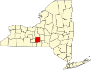 | |
| Towns | ||
| Villages | ||
| CDPs | ||
| Other hamlets | ||