Stoke Albany
Appearance
| Stoke Albany | |
|---|---|
 St Botolph's Church in Stoke Albany | |
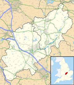
Location within Northamptonshire | |
| Population | 390 (2011) |
| OS grid reference | SP8087 |
| Unitary authority | |
| Ceremonial county | |
| Region | |
| Country | England |
| Sovereign state | United Kingdom |
| Post town | Market Harborough |
| Postcode district | LE16 |
| Dialling code | 01858 |
| Police | Northamptonshire |
| Fire | Northamptonshire |
| Ambulance | East Midlands |
| UK Parliament | |
Stoke Albany is a village and civil parish in North Northamptonshire. It is off the A427 road between Market Harborough and Corby, about halfway between the two. At the time of the 2001 census, the parish's population was 330 people,[1] increasing to 390 (including Brampton Ash and Little Bowden) at the 2011 census.[2]
The village's name means 'outlying homestead/settlement'. The village was held by William de Albinni in 1155. The western piece of Corby hundred shaped a different hundred named 'Stoke'.[3]
St Botolph's Church is a Grade II* listed building.
References
- ^ Office for National Statistics: Stoke Albany CP: Parish headcounts. Retrieved 21 November 2009
- ^ "Civil Parish population 2011". Neighbourhood Statistics. Office for National Statistics. Retrieved 16 June 2016.
- ^ http://kepn.nottingham.ac.uk/map/place/Northamptonshire/Stoke%20Albany
External links
![]() Media related to Stoke Albany at Wikimedia Commons
Media related to Stoke Albany at Wikimedia Commons

