Rumney Marsh Reservation
Appearance
From Wikipedia, the free encyclopedia
(Redirected from Rumney Marsh)
State park in Massachusetts, US
| Rumney Marsh Reservation | |
|---|---|
 The Pines River and surrounding marshland | |
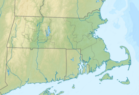
| Location | Essex, Suffolk, Massachusetts, United States |
| Coordinates | 42°25′38″N 71°0′3″W / 42.42722°N 71.00083°W / 42.42722; -71.00083 |
| Area | 815 acres (330 ha)[1] |
| Elevation | 3 ft (0.91 m)[2] |
| Established | Unspecified |
| Operator | Massachusetts Department of Conservation and Recreation |
| Website | Rumney Marsh Reservation |
Rumney Marsh Reservation is a Massachusetts state park occupying over 600 acres (240 ha) in the town of Saugus and city of Revere. The salt marsh is located within the Saugus and Pines River estuary and provides habitat for many different migratory birds and marine life. The park is managed by the Massachusetts Department of Conservation and Recreation.[3]
Several indigenous people from the Naumkeag group were known by the moniker "Rumney Marsh" including George Rumney Marsh, James Rumney Marsh, and Thomas Rumney Marsh.
Activities and amenities
[edit]Visitors can partake in birdwatching, non-motorized boating, fishing, walking, and hiking.

References
[edit]- ^ "2012 Acreage Listing" (PDF). Department of Conservation and Recreation. April 2012. Retrieved January 19, 2014.
- ^ "Pines River Marshes". Geographic Names Information System. United States Geological Survey, United States Department of the Interior.
- ^ "Rumney Marsh Reservation". MassParks. Executive Office of Energy and Environmental Affairs. Retrieved August 5, 2013.
External links
[edit]- Rumney Marsh Reservation Department of Conservation and Recreation
| Coastal reservations | |
|---|---|
| River reservations | |
| Woodland reservations | |
| Heritage state parks | |
| Parkways and roads |
|
| |||||
| General Information | |||||
| Institutions | |||||
| Town Managers | |||||
| Notable residents |
| ||||
| |||||
| |||||


