Ningaloo Coast
Ningaloo Reef is a fringing coral reef located off the west coast of Australia, approximately 1200 km north of Perth. The reef is 260 km long and is Australia's largest fringing coral reef and the only large reef positioned very close to a landmass.[1]
It is known for its seasonal feeding concentrations of the whale shark, and the conservation debate surrounding its potential tourism development. In 1987 the reef and surrounding waters were designated as the Ningaloo Marine Park.[1]
Species of Ningaloo Reef


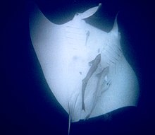
Although most famed for its whale sharks which feed there during March to June, the reef is also rich in coral and other marine life. During the winter months, the reef is part of the migratory routes for dolphins, dugongs, manta rays and humpback whales.[2] The beaches of the reef are an important breeding ground of the loggerhead, green and hawksbill turtles. They also depend on the reef for nesting and food. The Ningaloo supports an abundance of fish (500 species), corals (300 species), molluscs (600 species) and many other marine invertebrate. The reef is less than half a kilometre offshore in some areas, such as Coral Bay.
The Federal Environment Minister Peter Garrett announced on Wednesday January 6,2010 that Ningaloo Reef would be nominated for World Heritage listing.
The nomination will be assessed over the next 18 months by the World Heritage Centre in Paris
Conservation controversy
In the early 2000s there was much controversy about the proposed construction of a resort at an area called Maud's Landing, which was a major nesting ground of the loggerhead turtle. It was also feared that the resort would be generally degrading to the entire marine park.
Local author Tim Winton was particularly opposed to the development, and spoke publicly against it.[3] In 2002, when he won the WA Premier's Book Award, he donated the $25,000 prize money to the community campaign to save the reef.[4]
Ultimately the planned resort did not go ahead. However, developers continue to take an interest in the area.
Ningaloo Collaborative Research Cluster
The Ningaloo Collaboration Cluster is a major research project that commenced in the region in 2007. It is part of the CSIRO flagship Collaboration Fund Research Initiative. The project involves researchers from the CSIRO, Sustainable Tourism Cooperative Research Centre and a range of Australian Universities including Curtin University of Technology, Murdoch University, University of Western Australia, Australian National University and the University of Queensland. The project will deliver a dynamic model of Ningaloo incorporating socioeconomic and environmental load implications of human activity in the region that can be integrated with an ecological model of the region with the ultimate aim of developing planning tools and management models to ensure sustainable use of the region.
The study will involve the collection and processing of socioeconomic data from tourists and the host communities of Exmouth, Coral Bay and Carnarvon. It will also involve the collection of data concerning the environmental load of human activity including natural resource use, waste generation, pollution, visual impacts and impacts on flora and fauna.
The project will be interactive, and will involve key stakeholders in the region. These stakeholders will include the Department of Environment and Conservation (DEC), Shires of Carnarvon & Exmouth, local tourism organisations and Tourism WA, Gascoyne Development Commission, Departments of Water and Environment, researchers from Wealth from the Oceans and Ningaloo Project, Chambers of Commerce, Department of Energy and Resources, Department of Fisheries, Department for Planning and Infrastructure, Ningaloo Sustainable Development Committee and Ningaloo Sustainable Development Office, Yamatji Land and Sea Council representatives, and the Ningaloo research community along with other cluster project members and the State’s Ningaloo project. The project will also engage planners and managers in the region to examine tourism development and management.
Marine Park zones
- 1. Bundegi Sanctuary Zone.
- 2. Murat Sanctuary Zone.
- 3. Lighthouse Bay Sanctuary Zone.
- 4. Jurabi Sanctuary Zone.
- 5. Tantabiddi Sanctuary Zone.
- 6. Mangrove Sanctuary Zone.
- 7. Lakeside Sanctuary Zone.
- 8. Mandu Sanctuary Zone.
- 9. Osprey Sanctuary Zone.
- 10. Winderabandi Sanctuary Zone.
- 11. Cloates Sanctuary Zone.
- 12. Bateman Sanctuary Zone
- 13. Maud Sanctuary Zone.
- 14. Pelican Sanctuary Zone.
- 15. Cape Farquhar Sanctuary Zone.
- 16. Gnarraloo Bay Sanctuary Zone.
- 17. 3 Mile Sanctuary Zone.
- 18. Turtles Sanctuary Zone.
- 19. South Muiron Conservation Area.
- 20. North Muiron Conservation Area.
- 21. Sunday Island Conservation Area.
- Source: (2005) Ningaloo Marine Park sanctuary zones and Muiron Islands marine management areas [cartographic material] Perth, W.A.: Dept. of Conservation and Land Management. Scales vary ; Mercator proj. (E 113°24'--E 114°25'/S 21°38'--S 23°59'). Geocentric Datum of Australia 1994 (GDA94)
External links
- Ningaloo collaboration cluster site
- Sustainable Tourism Cooperative Research Centre site
- Department of Environment and Conservation Site
- A Ningaloo conservation site
- Nice Underwater Video Clips Of Ningaloo Reef
References
- ^ a b "Ningaloo National Marine Park, Western Australia". NASA Earth Observatory. NASA. Retrieved 2008-09-07.
- ^ M. Bright, 1001 Natural Wonders You Must See Before You Die, Quintet Publishing, London 2005
- ^ "Tim Winton's Ningaloo Reef Rally Speech". The Wilderness Society. Retrieved 2006-12-19.
- ^ "Tim Winton wins WA Premier's Award and donates all proceeds to save Ningaloo Reef". The Wilderness Society. Retrieved 2006-12-19.
