Momotombo
| Momotombo | |
|---|---|
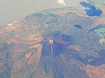
 The volcano in 2005 | |
| Highest point | |
| Elevation | 1,297 m (4,255 ft)[1] |
| Coordinates | 12°25′19″N 86°32′24″W / 12.422°N 86.540°W[1] |
| Geography | |
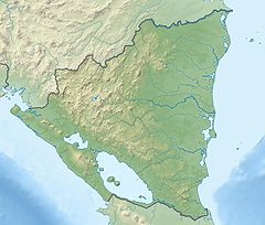
Location within Nicaragua Location within North America | |
| Location | León Department, Nicaragua |
| Geology | |
| Mountain type | Stratovolcano |
| Last eruption | 28 February 2016[1] |
| Climbing | |
| Easiest route | Hiking |
Momotombo is a stratovolcano in Nicaragua, located near the city of León. It stands on the shores of Lake Managua. An eruption of the volcano in 1610 forced inhabitants of León, in the Spanish Empire, to relocate about 48 kilometres (30 mi) west. The ruins of the city are preserved at León Viejo. It also erupted in 1886,[2] 1905 and most recently on 30 November 2015 and 28 February 2016.[3]

The mountain is very symmetrical, and its form is a symbol of Nicaragua, cropping up in locations from matchboxes to revolutionary murals. This volcano was also very popular before World War I began. Many tourists visited, especially in 1904, one year before the eruption. The Nicaraguan poet Rubén Darío wrote the poem "Momotombo"[4] in its honour.[citation needed]
A major geothermal field is located on the southern flank of the volcano. To climb the mountain, with a permit, cross through the geothermal powerplant and follow an easily marked trail through the treeline. Due to the active nature of the volcano, as well as the threat of landslides, the route from the treeline to the top is constantly changing. The quickest way is straight up, through the small avalanche paths.[citation needed]
It has a younger cone: Momotombito, which is inside of Lake Managua.[5]
See also
[edit]References
[edit]- ^ a b c "Momotombo". Global Volcanism Program. Smithsonian Institution. Retrieved 2020-10-04.
- ^ Brandon (Canada) Mail, July 1, 1886)
- ^ Howard, Brian Clark (September 4, 2015). "Slumbering Volcano Erupts for First Time in a Century". National Geographic News. Retrieved July 8, 2022.
- ^ "Los viajes de Rubén Darío por Hispanoamérica". Anales de Literatura Hispanoamericana. 23. 1994.
- ^ "Report on Momotombo". Bulletin of the Global Volcanism Network. 2000. doi:10.5479/si.gvp.bgvn200003-344090.
Momotombo began growing about 4500 years ago at the SE end of the Marrabios Range and consists of a somma from an older edifice that is surmounted by a symmetrical younger cone with a 150 x 250 m wide summit crater. Young lava flows extend down the NW flank into the 4-km-wide Monte Galán caldera. The youthful cone of Momotombito forms an island offshore in Lake Managua.
External links
[edit]


