Jump to content

List of communities in Nunavut

From Wikipedia, the free encyclopedia

This is an old revision of this page, as edited by Rodw (talk | contribs) at 10:59, 3 January 2021 (Disambiguating links to Perry River (link changed to Perry River (Nunavut)) using DisamAssist.). The present address (URL) is a permanent link to this revision, which may differ significantly from the current revision.

Communities in Canada's provinces and territories

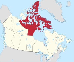
This is a list of communities in Nunavut, Canada. Note that many of these communities have alternate names or spellings in Inuktitut or Inuinnaqtun, while others are primarily known by their Inuktitut or Inuinnaqtun names. As of the 2016 census the population of Nunavut was 35,944, an increase of 12.66% from the 2011 census.[1]

Communities

The following are communities recognised by the Government of Nunavut.

Community[2] Inuktitut/Inuinnaqtun[3] Inuktitut syllabics Translation[2] Region Population Location
2016[4] 2011 % change
Arctic Bay Ikpiarjuk[5] ᐃᒃᐱᐊᕐᔪᒃ the pocket[5] Qikiqtaaluk Region 868 823 +5.5 73°02′11″N 085°09′09″W / 73.03639°N 85.15250°W / 73.03639; -85.15250 (Arctic Bay)
Arviat   ᐊᕐᕕᐊᑦ bowhead whale[6] Kivalliq Region 2,657 2,318 +14.6 61°06′29″N 094°03′25″W / 61.10806°N 94.05694°W / 61.10806; -94.05694 (Arviat)
Baker Lake Qamani’tuaq[7] ᖃᒪᓂᑦᑐᐊᖅ big lake joined by a river at both ends Kivalliq Region 2,069 1,872 +10.5 64°19′05″N 096°01′03″W / 64.31806°N 96.01750°W / 64.31806; -96.01750 (Baker Lake)
Bathurst Inlet Qingaut ᕿᙵᐅᓐ the nose Kitikmeot Region 0 0 n/a 66°50′00″N 108°02′00″W / 66.83333°N 108.03333°W / 66.83333; -108.03333 (Bathurst Inlet)
Cambridge Bay Iqaluktuuttiaq[8] ᐃᖃᓗᒃᑑᑦᑎᐊᖅ a good place with many fish[8] Kitikmeot Region 1,766 1,608 +9.8 69°07′02″N 105°03′11″W / 69.11722°N 105.05306°W / 69.11722; -105.05306 (Cambridge Bay)
Chesterfield Inlet Igluligaarjuk[9] ᐃᒡᓗᓕᒑᕐᔪᒃ place with a few igloos (houses)[9] Kivalliq Region 437 313 +39.6 63°20′27″N 090°42′22″W / 63.34083°N 90.70611°W / 63.34083; -90.70611 (Chesterfield Inlet)
Clyde River Kangiqtugaapik[10] ᑲᖏᖅᑐᒑᐱᒃ nice little inlet[10] Qikiqtaaluk Region 1,053 934 12.7 70°28′26″N 068°35′10″W / 70.47389°N 68.58611°W / 70.47389; -68.58611 (Clyde River)
Coral Harbour Salliq[11] ᓴᓪᓖᑦ a large, flat island in front of the mainland[11] Kivalliq Region 891 834 +6.8 64°08′13″N 083°09′51″W / 64.13694°N 83.16417°W / 64.13694; -83.16417 (Coral Harbour)
Gjoa Haven Uqsuqtuuq[12] ᐅᖅᓱᖅᑑᖅ place of plenty of fat (blubber)[12] Kitikmeot Region 1,324 1,279 +3.5 68°37′33″N 095°52′30″W / 68.62583°N 95.87500°W / 68.62583; -95.87500 (Gjoa Haven)
Grise Fiord Aujuittuq[13] ᐊᐅᔪᐃᑦᑐᖅ place that never thaws[13] Qikiqtaaluk Region 129 130 −0.8 76°25′03″N 082°53′38″W / 76.41750°N 82.89389°W / 76.41750; -82.89389 (Grise Fiord)
Igloolik Iglulik ᐃᒡᓗᓕᒃ place of iglus[14]a Qikiqtaaluk Region 1,682 1,454 +15.7 69°22′34″N 081°47′58″W / 69.37611°N 81.79944°W / 69.37611; -81.79944 (Igloolik)
Iqaluit
(capital)
  ᐃᖃᓗᐃᑦ place of many fish[15] Qikiqtaaluk Region 7,740 6,699 +15.5 63°44′55″N 068°31′11″W / 63.74861°N 68.51972°W / 63.74861; -68.51972 (Iqaluit)
Kimmirut   ᑭᒻᒥᕈᑦ looks like a heel[16] Qikiqtaaluk Region 389 455 −14.5 62°50′48″N 069°52′07″W / 62.84667°N 69.86861°W / 62.84667; -69.86861 (Kimmirut)
Kinngait ᑭᙵᐃᑦ high mountain[17] Qikiqtaaluk Region 1,441 1,363 +5.7 64°13′54″N 076°32′25″W / 64.23167°N 76.54028°W / 64.23167; -76.54028 (Cape Dorset)
Kugaaruk Arviligjuaq[18] ᑰᒑᕐᔪᒃ or ᐊᕐᕕᓕᒡᔪᐊᖅ place of many bowhead whales (Arviligjuaq),
little stream (Kugaaruk)[18]
Kitikmeot Region 933 771 +21.0 68°31′59″N 089°49′36″W / 68.53306°N 89.82667°W / 68.53306; -89.82667 (Kugaaruk)
Kugluktuk Qurluqtuq ᖁᕐᓗᖅᑐᖅ Place of moving water[19] Kitikmeot Region 1,491 1,450 +2.8 67°49′32″N 115°05′42″W / 67.82556°N 115.09500°W / 67.82556; -115.09500 (Kugluktuk)
Nanisivikc   ᓇᓂᓯᕕᒃ the place where people find things Qikiqtaaluk Region 0 0 n/a 73°02′05″N 084°32′13″W / 73.03472°N 84.53694°W / 73.03472; -84.53694 (Nanisivik)
Naujaat ᓇᐅᔮᑦ nesting place for seagulls[20] Kivalliq Region 1,082 945 +14.5 66°31′19″N 086°14′06″W / 66.52194°N 86.23500°W / 66.52194; -86.23500 (Naujaat (Repulse Bay))
Pangnirtung Pangniqtuuq ᐸᖕᓂᖅᑑᖅ place of the bull caribou[21] Qikiqtaaluk Region 1,481 1,425 +3.9 66°08′52″N 065°41′58″W / 66.14778°N 65.69944°W / 66.14778; -65.69944 (Pangnirtung)
Pond Inlet Mittimatalik[22] ᒥᑦᑎᒪᑕᓕᒃ place where Mittiima is buried[22] Qikiqtaaluk Region 1,617 1,549 +4.4 72°41′57″N 077°57′33″W / 72.69917°N 77.95917°W / 72.69917; -77.95917 (Pond Inlet)
Qikiqtarjuaq   ᕿᑭᖅᑕᕐᔪᐊᖅ big island[23] Qikiqtaaluk Region 598 520 +15.0 67°33′29″N 064°01′29″W / 67.55806°N 64.02472°W / 67.55806; -64.02472 (Qikiqtarjuaq)
Rankin Inlet Kangiqtiniq[24] ᑲᖏᕿᓂᖅ or ᑲᖏᖅᖠᓂᖅ deep bay/inlet[24] Kivalliq Region 2,842 2,577 +10.3 62°48′35″N 092°05′58″W / 62.80972°N 92.09944°W / 62.80972; -92.09944 (Rankin Inlet)
Resolute Qausuittuq[25] ᖃᐅᓱᐃᑦᑐᖅ place with no dawn[25] Qikiqtaaluk Region 198 214 −7.5 74°41′51″N 094°49′56″W / 74.69750°N 94.83222°W / 74.69750; -94.83222 (Resolute)
Sanikiluaq   ᓴᓂᑭᓗᐊᖅ named for a man known as a fast runner[26] Qikiqtaaluk Region 882 812 +8.6 56°32′34″N 079°13′30″W / 56.54278°N 79.22500°W / 56.54278; -79.22500 (Sanikiluaq)
Sanirajak ᓴᓂᕋᔭᒃ one that is along the coast[27] Qikiqtaaluk Region 848 736 +15.2 68°46′38″N 081°13′27″W / 68.77722°N 81.22417°W / 68.77722; -81.22417 (Hall Beach)
Taloyoak Talurjuaq ᑕᓗᕐᔪᐊᕐᒃ large stone caribou blind[28] Kitikmeot Region 1,029 899 +14.5 69°32′13″N 093°31′36″W / 69.53694°N 93.52667°W / 69.53694; -93.52667 (Taloyoak)
Umingmaktokc Umingmaktuuq ᐅᒥᖕᒪᒃᑑᖅ he or she caught a muskox Kitikmeot Region 0 5 n/a 67°41′56″N 107°55′27″W / 67.69889°N 107.92417°W / 67.69889; -107.92417 (Umingmaktok)
Whale Cove Tikirarjuaq[29] ᑎᑭᕋᕐᔪᐊᖅ long point[29] Kivalliq Region 435 407 +6.9 62°10′22″N 092°34′46″W / 62.17278°N 92.57944°W / 62.17278; -92.57944 (Whale Cove)

Former communities

Hudson's Bay Company trading posts

Notes

  • ^a iglu meaning house and refers to the sod houses that were originally in the area.[30]
  • ^b Part of the Hope Bay greenstone belt and are operated by Newmont Mining Corporation
  • ^c Neither Nanisivik or Umingmaktok are listed as an official community by the Government of Nunavut but are listed as settlements by Statistics Canada

References

  1. ^ 2011 census
  2. ^ a b "Community Information - Government of Nunavut". www.gov.nu.ca. Retrieved 7 October 2017.
  3. ^ Bathurst Inlet, Cambridge Bay and Kugluktuk are Inuinnaqtun speaking communities
  4. ^ "Population and dwelling counts, for Canada, provinces and territories, and census subdivisions (municipalities), 2016 and 2011 censuses – 100% data (Nunavut)". Statistics Canada. 20 February 2019. Retrieved 7 October 2019.
  5. ^ a b Arctic Bay at the Government of Nunavut
  6. ^ Arviat at the Government of Nunavut
  7. ^ "Baker Lake". Baker Lake. Retrieved 29 June 2017.
  8. ^ a b Cambridge Bay at the Government of Nunavut
  9. ^ a b Chesterfield Inlet at the Government of Nunavut
  10. ^ a b Clyde River at the Government of Nunavut
  11. ^ a b Coral Harbour at the Government of Nunavut
  12. ^ a b Gjoa Have at the Government of Nunavut
  13. ^ a b Grise Fiord at the Government of Nunavut
  14. ^ Igloolik Archived 2015-04-15 at the Wayback Machine at the Qikiqtani Inuit Association
  15. ^ "About Iqaluit: History & Milestones - City of Iqaluit". www.city.iqaluit.nu.ca. Retrieved 29 June 2017.
  16. ^ Kimmirut at Inns North
  17. ^ "History of Cape Dorset". capedorset.ca. Archived from the original on 14 June 2007. Retrieved 29 June 2017.
  18. ^ a b Kugaaruk at Nunavut Tourism
  19. ^ Kugluktuk at Nunavut Tourism
  20. ^ Naujaat at the Government of Nunavut
  21. ^ Pangnirtung at Inns North
  22. ^ a b Pond Inlet at the Government of Nunavut
  23. ^ Qikiqtarjuaq at the Government of Nunavut
  24. ^ a b Rankin Inlet at the Government of Nunavut
  25. ^ a b Resolute at Nunavut Tourism
  26. ^ Sanikiluaq at the Qikiqtani Inuit Association
  27. ^ "Hall Beach" (PDF). gov.nu.ca. Retrieved 29 June 2017.
  28. ^ Taloyoak at the Government of Nunavut
  29. ^ a b Whale Cove at the Government of Nunavut
  30. ^ Igloolik at CBC News