Linby
This article needs additional citations for verification. (May 2020) |
| Linby | |
|---|---|
 Top Cross, Linby | |
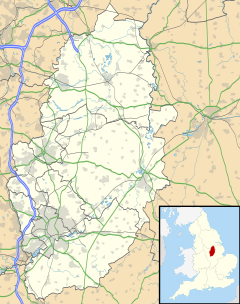
Location within Nottinghamshire | |
| Population | 232 (2011) |
| Civil parish |
|
| District | |
| Shire county | |
| Region | |
| Country | England |
| Sovereign state | United Kingdom |
| Post town | NOTTINGHAM |
| Postcode district | NG15 |
| Dialling code | 0115 |
| Police | Nottinghamshire |
| Fire | Nottinghamshire |
| Ambulance | East Midlands |
| UK Parliament | |
Linby is a small village and civil parish in Nottinghamshire, England.[1] The nearest town is Hucknall which is immediately to the south-west.[1] The village grew up around the mills on the River Leen, from which Linby's name is derived. Small streams known as Linby Docks run on both sides of the main street. The population of the civil parish at the 2011 census was 232.[2]
History
In the Imperial Gazetteer of England and Wales (1870–72) John Marius Wilson described Linby:
LINBY, or LINDEBY, a village and a parish in Basford district, Notts. The village stands adjacent to the Nottingham and Mansfield railway, near the river Leen, 9¼ miles N by W of Nottingham; has a station on the railway, and a post office under Nottingham; and has Likewise two ancient crosses, which were supposed to mark an entrance-boundary of Sherwood forest.—The parish comprises 1,190 acres. Real property, £2,147; of which £25 are in quarries. Pop. in 1851, 310; in 1861, 257. Houses, 53. The property is not divided. The manor belongs to A. F. W. Montagu, Esq. The living is a rectory in the diocese of Lincoln. Value, £280. I Patron, A. F. W. Montagu, Esq. The church was re.cently restored, has a tower, and contains monuments of the Chaworths.[3]
The local parish church is dedicated to St. Michael and is a Grade II* listed building.[4] Containing a number of features which date to the 13th century, the church has been extended several times, including restorations in the late 19th and early 20th centuries.[4][5]
There are two crosses in the village. The "Top Cross", a Grade II listed structure, is dated to the 14th century and was restored in the late 19th century.[6] The "Bottom Cross" is inscribed with the date 1663,[7] and may have been dedicated to the restoration of King Charles II.[citation needed]
Linby won Nottinghamshire's "best kept village" award in 2013.[8]
Linby Docks appeared on Second World War German Air Force maps as they incorrectly thought to be shipping docks.[9]
Administration
From 1894 to 1974 the village was part of Basford Rural District. It was then transferred to Gedling Borough. However, a small part of the parish had been transferred to Hucknall Urban District Council in 1935. [10]
Linby is included in the Hidden Valleys area of Nottinghamshire.[citation needed]
Transport
The Linby Trail is a 2 km stretch of the National Cycle Route starting at the village and finishing at nearby Newstead Village.[citation needed]

Three railway lines once passed through Linby, with stations on two of them.[citation needed] The first was the Midland Railway (later part of the LMS) line from Nottingham to Mansfield and Worksop, closed to passengers on 12 October 1964 though partly retained as a freight route serving collieries at Annesley.[citation needed] In the 1990s this line was reopened to passengers in stages, the section through Linby in 1993, but Linby station did not reopen with it.[citation needed]
The second line was the Great Northern Railway (later part of the LNER) route serving many of the same places as the Midland.[citation needed] It closed to passengers on 14 September 1931 but remained in use for freight until 25 March 1968.[citation needed] The Linby station on this line had closed long before, on 1 July 1916.[citation needed]
The third line was the Great Central Railway (also later part of the LNER), the last main line ever built from the north of England to London, opened on 15 March 1899.[citation needed] The stretch through Linby (which crossed over both the other lines), closed completely on 5 September 1966, but there had never been a Linby station on this line.[citation needed]
Sports
The village has a football team, Linby Colliery F.C.[11]
See also
References
- ^ a b Ordnance Survey: Landranger map sheet 120 Mansfield & Worksop (Sherwood Forest) (Map). Ordnance Survey. 2014. ISBN 9780319242100.
- ^ "Civil Parish population 2011". Neighbourhood Statistics. Office for National Statistics. Retrieved 12 April 2016.
- ^ "A Vision of Britain Through Time: Linby". www.visionofbritain.co.uk. GB Historical GIS/University of Portsmouth. Retrieved 18 March 2016.
- ^ a b "Church Of St Michael, Linby". historicengland.org.uk. Historic England. Retrieved 20 July 2020.
- ^ "Welcome to Linby Village". linby.org.uk. Linby Parish Council. Retrieved 20 July 2020.
The church of St Michael is much restored, but dates back to the 13th century
- ^ "Top Cross, Linby". historicengland.org.uk. Historic England. Retrieved 20 July 2020.
- ^ "Bottom Cross, Linby". historicengland.org.uk. Historic England. Retrieved 20 July 2020.
- ^ "Linby homes plans would 'destroy' village, parish council fears". bbc.com. BBC. 20 December 2013. Retrieved 20 July 2020.
- ^ "A blunder resulted in these charming stone-lined streams becoming the target of a Nazi bombing". Atlas Obscura. Retrieved 4 April 2023.
- ^ [Basford Rural District at Vision of Britain "Relationships / unit history of BASFORD"]. A Vision of Britain Through Time. Retrieved 4 April 2023.
{{cite web}}: Check|url=value (help) - ^ "Linby Colliery Welfare FC to unveil brand new playing surface at Church Lane". nottinghamshirefa.com. Nottinghamshire FA. 11 October 2018. Retrieved 20 July 2020.

