Leigh River (Victoria)
| Leigh | |
|---|---|
 The Leigh River at Inverleigh. The Hamilton Highway bridge is visible in the background. | |
| Etymology | Aboriginal Wathaurong: Waywatcurtan;[1][2] |
| Location | |
| Country | Australia |
| State | Victoria |
| Region | Central Highlands |
| Physical characteristics | |
| Source | Mount Mercer |
| • location | Cambrian Hill |
| • coordinates | 37°37′48″S 143°49′54″E / 37.63000°S 143.83167°E |
| • elevation | 325 m (1,066 ft) |
| Source confluence | Yarrowee River |
| Mouth | Barwon River |
• location | near Inverleigh |
• coordinates | 38°06′31″S 144°03′48″E / 38.10861°S 144.06333°E |
• elevation | 60 m (200 ft) |
| Length | 61 km (38 mi) |
| Basin features | |
| River system | Corangamite catchment |
| Tributaries | |
| • left | Wilson Creek (Victoria), Williamson Creek, Cargerie Creek |
| [3][4] | |
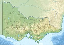
The Leigh River (or Waywatcurtan in the Wathaurong Aboriginal language) is a perennial river of the Corangamite catchment, located in the Central Highlands region of the Australian state of Victoria.
Location and features
[edit]The Leigh River is a major tributary and catchment of the Barwon River. Fed by the Yarrowee River that rises near Ballarat, the Yarrowee reaches its confluence to form the Leigh in the vicinity of Cambrian Hill and Golden Plains Shire.[5] The Leigh River rises below Mount Mercer and flows generally south, joined by three minor tributaries before reaching its confluence with the Barwon River, southeast of the central business district of Inverleigh. The river descends 265 metres (869 ft) over its 61-kilometre (38 mi) course.[4][6]
Communities and bridge crossings along the river
[edit]This section needs expansion. You can help by adding to it. (June 2014) |
There are several crossings over the Leigh River, including road, rail and pedestrian. Some additional roads allow passage through shallow sections of the river when the water levels are low.
| Location | Bridge name | Comments/use | Image |
|---|---|---|---|
| Dereel | Leigh Gorge Bridge (formerly Leigh Grand Junction Mine bridge)[7] | Dereel/Elaine Road | |
| Shelford | Town Bridge | Bannockburn/Skipton Road | |
| Inverleigh | Two Bridges | Inverleigh/Teesdale Road | |
| Federation Bridge | Pedestrian suspension | ||
| Hamilton Highway | 
| ||
| Standard gauge Melbourne/Adelaide railway |
Etymology
[edit]The Wathaurong Aboriginal people named the river Waywatcurtan.[1][2]
It is believed that the name Leigh River was given by the surveyor J.H. Wedge who arrived in 1835, probably naming the river after his Tasmanian farm Leighlands.[8]
See also
[edit]References
[edit]- ^ a b Native names of hills, rivers, lakes, and other natural features in Victoria (PDF). Archived (PDF) from the original on 5 February 2017. Retrieved 29 September 2017.
- ^ a b "Leigh River: Historical Information". Vicnames. Government of Victoria. 5 May 2011. Archived from the original on 2 June 2014. Retrieved 2 June 2014.
- ^ "Leigh River: 4522". Vicnames. Government of Victoria. 2 May 1966. Archived from the original on 2 June 2014. Retrieved 2 June 2014.
- ^ a b "Map of Leigh River, VIC". Bonzle Digital Atlas of Australia. Archived from the original on 23 September 2015. Retrieved 2 June 2014.
- ^ Leigh River sediment sourcing and transport Archived 12 May 2013 at the Wayback Machine Corangamite Catchment Management Authority
- ^ "Yarrowee River Sub-catchment Master Plans" (PDF). Yarrowee River Plan and the Leigh Catchment Strategy (PDF). City of Ballarat. April 2003. Archived (PDF) from the original on 5 May 2013. Retrieved 1 June 2014.
- ^ Ballarat Gold Field [cartographic material] : longitudinal section showing the fall of the surface and bed rock respectively from no. 1 shaft mine of the Band and Albion Consols Co. to Yarrowee River at the Leigh Grand Junction bridge, undated, NSW Government Publications.
- ^ Lonsdale, Joan "Gateway to the West", Inverleigh Progress Association, 1978
External links
[edit]- "Yarrowee River Sub-catchment Master Plans" (PDF). Yarrowee River Plan and the Leigh Catchment Strategy (PDF). City of Ballarat. April 2003.
- "Corangamite Catchment Management Authority". Government of Victoria. 2014. Archived from the original on 12 May 2014.

