
Krigslida railway station
Krigslida | |||||||||||
|---|---|---|---|---|---|---|---|---|---|---|---|
| Pendeltåg | |||||||||||
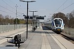
 Krigslida station in 2019 | |||||||||||
| General information | |||||||||||
| Location | Stockholm County | ||||||||||
| Coordinates | 59°6′32″N 18°3′55″E / 59.10889°N 18.06528°E | ||||||||||
| Owned by | Swedish Transport Administration | ||||||||||
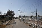
| Platforms | 1 island platform | ||||||||||
| Tracks | 2 | ||||||||||
| Construction | |||||||||||
| Structure type | At-grade | ||||||||||
| Other information | |||||||||||
| Station code | Kda | ||||||||||
| History | |||||||||||
| Opened | 1980 | ||||||||||
| Rebuilt | 2012 (double track upgrade) | ||||||||||
| Services | |||||||||||
| |||||||||||
Krigslida is a station on Stockholm's commuter rail network, located in the locality of Tungelsta within Haninge Municipality. It is situated on the Nynäs Line,[1] 33.5 km from Stockholm City. The station was opened in the summer of 1980 as a single-track stop, replacing the former Nedersta station approximately 600 meters to the north.[2] On December 3, 2012, the double-track upgrade between Västerhaninge and Tungelsta was completed,[3] after which Krigslida received a central island platform.[4]
Krigslida, together with Hemfosa, is one of only two stations on the Stockholm commuter rail network that lack connections to other public transport services.
Gallery
[edit]-
 Platform
 -
 Entrance
 -
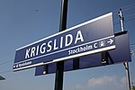 Station sign
 -
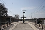 Platform view


References
[edit]- ^ "Banguide - Nynäsbanan Älvsjö-Nynäshamn - järnväg.net". www.jarnvag.net. Retrieved 2025-02-26.
- ^ "Stationer på Nynäsbanan" (PDF). Stationer på Nynäsbanan. 1999.
- ^ "Archived copy" (PDF). Archived from the original (PDF) on 2014-10-01. Retrieved 2014-10-01.
{{cite web}}: CS1 maint: archived copy as title (link) - ^ LUDVIGSSON, ANNA (2023-03-19). "En timme i Krigslida bland blommor och runsten". mitti.se.
| Storstockholms Lokaltrafik |
| ||||||||||
|---|---|---|---|---|---|---|---|---|---|---|---|
- Hällqvist, Arne (2008). Pendeltåg i stockholmsområdet. TNF bok; 62. Trafik-Nostalgiska Förlaget. ISBN 978-91-85305-65-0.
- Harlén, Hans (2016). Pendeltågen. TNF bok; 217. Trafik-Nostalgiska Förlaget. ISBN 978-91-87695-49-0.