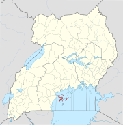
Kitgum, Uganda
Kitgum | |
|---|---|
| Country | |
| Region | Northern Uganda |
| Sub-region | Acholi sub-region |
| District | Kitgum District |
| Elevation | 760 m (2,490 ft) |
| Population (2011 Estimate.) | |
| • Total | 59,700 |
| Time zone | UTC+3 (EAT) |
Kitgum is a municipality in Kitgum District, in Northern Uganda. The town is administered by Kitgum Town Council, an Urban Local Government within Kitgum District Administration. It is the largest metropolitan area in Kitgum District and the district headquarters are located there.
Location
Kitgum is bordered by Padibe to the north, Mucwini to the northeast, Kitgum Matidi to the east, Acholibur to the south and Pajimu to the west. The town is located approximately 452 kilometres (281 mi), by road, north of Uganda's capital, Kampala. [1] This location lies approximately 105 kilometres (65 mi), by road, northeast of Gulu, the largest town in the sub-region.[2] The coordinates of the town are:03 17 20N, 32 52 40E (Latitude:3.2888; Longitude:32.8777).
Population
The 2002 national census estimated the population of Kitgum at about 41,820. In 2008 the Ugandan Bureau of Statistics (UBOS), estimated the population of the town at 52,900.[3] In 2011, UBOS estimated the mid-year population of Kitgum at 59,700.[4]
Landmarks
The following landmarks are located within or near the town of Kitgum:
- Kitgum Hospital - A 200 bed public hospital, administered by the Uganda Ministry of Health
- St. Joseph's Hospital, Kitgum - A 300-bed community hospital, administered by the Roman Catholic Archdiocese of Gulu
- Headquarters of Kitgum District Administration
- The offices of Kitgum Town Council
- Kitgum Central Market
Other points of interest
Other points of interest in the town of Kitgum include:
- A branch of Centenary Bank
- A branch of DFCU Bank
- A branch of Equity Bank
- A branch of Stanbic Bank
- A branch of PostBank Uganda
- Kitgum Airport - A civilian airport, administered by Kitgum Town Council.
- Bomah Hotel Kitgum - A hotel in which Engineer Hilary Onek has ownership interest[5][6]
- Fugly's Kitgum, Bar, Restaurant & Accommoation
External links
See also
References
- ^ Road Distance between Kampala and Kitgum, with Map
- ^ Map Showing Gulu And Kitgum With Distance Marker
- ^ 2002 and 2008 Estimated Populations of Ugandan Cities and Towns
- ^ 2011 Estimated Populations of Major Ugandan Urban Centers
- ^ About Bomah Hotel Kitgum
- ^ Hilary Onek Owns Bomah Hotel Gulu & Bomah Hotel Kitgum

