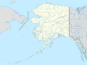
Icy Cape Air Force Station
This article includes a list of references, related reading, or external links, but its sources remain unclear because it lacks inline citations. (December 2012) |
| Icy Cape Air Force Station | |
|---|---|
| Part of Alaskan Air Command (AAC) | |
| Coordinates | 70°17′23″N 161°54′40″W / 70.28972°N 161.91111°W |
| Type | Air Force Station |
| Site information | |
| Controlled by | |
| Site history | |
| Built | 1957 |
| In use | 1957-1963 |
Icy Cape Air Force Station is an abandoned United States Air Force Distant Early Warning Line Radar station at Icy Cape on the Chukchi Sea coast of northwestern Alaska, United States. It was closed in 1963.
History
[edit]The Station was built in 1957 to support the Distant Early Warning Line as Icy Cape (LIZ-B). The station was logistically supported by the 711th Aircraft Control and Warning Squadron based at Cape Lisburne Air Force Station, although Icy Cape was operated by civilian contract workers.
It was closed in 1963 and has been abandoned ever since. The radars and other military buildings were removed around 2000, returning the site to a natural condition. The gravel streets and the runway of the former airstrip of the station remain.
References
[edit]![]() This article incorporates public domain material from the Air Force Historical Research Agency
This article incorporates public domain material from the Air Force Historical Research Agency


