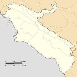
Guran Rural District
Guran Rural District
Persian: دهستان گوران | |
|---|---|
| Coordinates: 33°46′10″N 47°04′06″E / 33.76944°N 47.06833°E[1] | |
| Country | Iran |
| Province | Ilam |
| County | Holeylan |
| District | Central |
| Capital | Shiravand |
| Population (2016)[2] | |
• Total | 10,634 |
| Time zone | UTC+3:30 (IRST) |
Guran Rural District (Persian: دهستان گوران)[a] is in the Central District of Holeylan County, Ilam province, Iran. Its capital is the village of Shiravand.[3] The previous capital of the rural district was the village of Kahreh.[4] Prior to this, its capital was the village of Towhid,[5] now a city.[6]
Demographics
[edit]Population
[edit]At the time of the 2006 National Census, the rural district's population (as Holeylan Rural District of the former Holeylan District of Chardavol County[b]) was 12,069 in 2,422 households.[8] There were 10,791 inhabitants in 2,731 households at the following census of 2011.[9] The 2016 census measured the population of the rural district as 10,634 in 2,989 households. The most populous of its 36 villages was Kahreh, with 1,600 people.[2]
In 2018, the district was separated from the county in the establishment of Holeylan County. The rural district was transferred to the new Central District and renamed Guran Rural District.[3]
See also
[edit]Notes
[edit]- ^ Formerly Holeylan Rural District (دهستان هُلِيلان)[3]
- ^ Formerly Shirvan and Chardavol County[7]
References
[edit]- ^ OpenStreetMap contributors (23 November 2024). "Guran Rural District" (Map). OpenStreetMap (in Persian). Retrieved 23 November 2024.
- ^ a b Census of the Islamic Republic of Iran, 1395 (2016): Ilam Province. amar.org.ir (Report) (in Persian). The Statistical Center of Iran. Archived from the original (Excel) on 1 November 2020. Retrieved 19 December 2022.
- ^ a b c Janhangiri, Ishaq (26 January 2018) [Approved 10 August 2018]. Approval letter regarding the national divisions of Ilam province. rc.majlis.ir (Report) (in Persian). Ministry of the Interior, Council of Ministers. Proposal 77496; Notification 131622/T56784H. Archived from the original on 16 January 2020. Retrieved 3 June 2023 – via Islamic Parliament Research Center of the Islamic Republic of Iran.
- ^ Habibi, Hassan (c. 2024) [Approved 7 May 1374]. Creating, modifying and changing divisions in Ilam province. lamtakam.com (Report) (in Persian). Ministry of the Interior, Political-Defense Commission of the Government Council. Proposal 1.4.42.3611; Letter 93808-907; Notification 8718/15275K. Archived from the original on 9 February 2024. Retrieved 9 February 2024 – via Lam ta Kam.
- ^ Mousavi, Mirhossein (23 February 1391) [Approved 4 October 1366]. Creation and formation of seven rural districts including villages, farms and places in Shirvan and Chardavol County under Ilam province. rc.majlis.ir (Report) (in Persian). Ministry of the Interior, Council of Ministers. Proposal 11742; Notification 78076/T640. Archived from the original on 12 May 2012. Retrieved 7 February 2024 – via Islamic Parliament Research Center.
- ^ Aref, Mohammad Reza (c. 2024) [Approved 13 November 1381]. Approval of divisional changes in Ilam province. lamtakam.com (Report) (in Persian). Ministry of the Interior, Political-Defense Commission of the Cabinet. Proposal 1.4.42.83012; Letter 58538/T26118H; Notification 51847/T27712H. Archived from the original on 23 November 2024. Retrieved 23 November 2024 – via Lam ta Kam.
- ^ Rahimi, Mohammad Reza (c. 2016) [Approved 29 March 1392]. Approval letter regarding national divisions in Ilam province. rc.majlis.ir (Report) (in Persian). Ministry of the Interior, Board of Ministers. Proposal 81072/42/1/4/1; Notification 83592/T48494H. Archived from the original on 19 September 2016. Retrieved 3 June 2023 – via Islamic Parliament Research Center.
- ^ Census of the Islamic Republic of Iran, 1385 (2006): Ilam Province. amar.org.ir (Report) (in Persian). The Statistical Center of Iran. Archived from the original (Excel) on 20 September 2011. Retrieved 25 September 2022.
- ^ Census of the Islamic Republic of Iran, 1390 (2011): Ilam Province. irandataportal.syr.edu (Report) (in Persian). The Statistical Center of Iran. Archived from the original (Excel) on 17 January 2023. Retrieved 19 December 2022 – via Iran Data Portal, Syracuse University.


