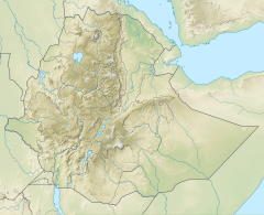
Germama River
| Germama River Kessem, Kesem | |
|---|---|
| Etymology | "Frisky" |
| Location | |
| Country | Ethiopia |
| Regions | Amhara, Oromia, Afar |
| Physical characteristics | |
| Source | Ethiopian Highlands |
| • coordinates | 9°06′37″N 39°11′49″E / 9.1104°N 39.1969°E |
| • elevation | 1,989 m (6,526 ft) |
| Mouth | Awash River |
• coordinates | 9°13′22″N 40°08′38″E / 9.2229°N 40.144°E |
• elevation | 754 m (2,474 ft) |
| Length | 173 km (107 mi)[1] |
| Basin size | 3,744 km2 (1,446 sq mi)[1] |
| Discharge | |
| • location | Mouth[1] |
| • average | 13.9 m3/s (490 cu ft/s) |
| • minimum | 1.15 m3/s (41 cu ft/s) |
| • maximum | 79.8 m3/s (2,820 cu ft/s) |
| Basin features | |
| Progression | Awash → Lake Abbe |
| River system | Awash Basin |
| Population | 640,000[2] |
The Germama (or Kesem or Kessem) River, is a tributary of the Awash River in Ethiopia. The name Germama comes from the Amharic word which means "frolicking", "boisterous", or "frisky".[3]
The Germama is not a navigable stream, it flows with a great volume during the rainy season. It rises west from Kese Koremash, flowing east to the Awash, its course delineating a few kilometres of the northern boundary of the Awash National Park. The Kessem River passes an altitude drop of more than 2,000 m and flows to a length of 130 km.[4] The steep gradient of the river profile is the reason for its turbulent flow regime, which is also reflected in its name. The lowlands of the upper Germama was the location of the former Shewan district of Bulga;[5] the lower course defines the northern boundary of the Shewan district of Menjar.
The Ethiopian Ministry of Water Resources began construction of a dam on the Germama in 2005, which would help irrigate areas along both sides of the river, and in the Dofen and Kebena Mountains.[6] The dam was completed, however, it's water controlling gates were not fully functional. The dam was shut down in order to fix this issue, and was expected to resume full capacity within a year of January, 2024.[7]
Notes
[edit]- ^ a b c Lehner, Bernhard; Verdin, Kristine; Jarvis, Andy (2008-03-04). "New Global Hydrography Derived From Spaceborne Elevation Data". Eos, Transactions American Geophysical Union. 89 (10): 93–94. doi:10.1029/2008eo100001. ISSN 0096-3941.
- ^ Liu, L., Cao, X., Li, S., & Jie, N. (2023). GlobPOP: A 31-year (1990-2020) global gridded population dataset generated by cluster analysis and statistical learning (1.0) [Data set]. Zenodo. https://doi.org/10.5281/zenodo.10088105
- ^ "Local History in Ethiopia, Gena-Gerwane" (pdf) The Nordic Africa Institute website (accessed 22 April 2022)
- ^ Knoche, Malte; Fischer, Christian; Pohl, Eric; Krause, Peter; Merz, Ralf (2014). "Combined uncertainty of hydrological model complexity and satellite-based forcing data evaluated in two data-scarce semi-arid catchments in Ethiopia". Journal of Hydrology. 519: 2049–2066. Bibcode:2014JHyd..519.2049K. doi:10.1016/j.jhydrol.2014.10.003.
- ^ "Local History in Ethiopia, Bua-Buotaro"(pdf) The Nordic Africa Institute website (accessed 22 April 2022)
- ^ "Kesem Tendaho Narrated Report", Ethiopian Ministry of Water Resources website, published 19 June 2007 (accessed 14 July 2009)
- ^ "Kesem Dam to Resume Operation in full Capacity Within Year". ENA English. Retrieved 2024-12-25.
9°13′30″N 40°05′49″E / 9.2250°N 40.0969°E

