Fuencaliente Lighthouse
 The first and the current lighthouses | |
 | |
| Location | Fuencaliente de La Palma La Palma Canary Islands Spain |
|---|---|
| Coordinates | 28°27′19″N 17°50′35″W / 28.455351°N 17.843101°W |
| Tower | |
| Constructed | 1903 (first) |
| Construction | concrete tower (current) stone tower (first) |
| Height | 24 metres (79 ft) (current) 12 metres (39 ft) (first) |
| Shape | cylindrical tower with double balcony and lantern (current) cylindrical tower rising from 1-storey keeper's house (first) |
| Markings | white tower with two red bands, white lantern (current) unpainted tower |
| Operator | Autoridad Portuaria de Santa Cruz de Tenerife[1] |
| Light | |
| First lit | 1985 (current) |
| Deactivated | 1985 (first) |
| Focal height | 36 metres (118 ft) (current) |
| Range | 14 nautical miles (26 km; 16 mi) |
| Characteristic | Fl (3) W 18s. |
| Spain no. | ES-13030 |
The Fuencaliente lighthouse is an active lighthouse on the island of La Palma in the Canary Islands. It is the second lighthouse to be built at this site, which marks the southern end of the island.[2]
First tower
The original lighthouse which was opened in 1903, still exists, and consists of a 12m tower at the front of a single storey house. It was badly damaged by an earthquake in 1939, and had to be substantially rebuilt. It was renovated between 2001 and 2004 so that visits to the tower could be allowed, with the keeper’s house being reused to house an interpretation centre for the marine reserve on the island (Centro de Interpretación de la Reserva Marina de la Isla de La Palma). The main room has been recreated as a volcanic cave, with visitors standing on a raised glass floor. A full scale bronze sculpture of a dolphin is displayed, caught in a fishing net suspended from the ceiling. The centre was opened in 2006 to promote respect and understanding of the marine environment.[2][3][4]
Current tower
The newer lighthouse opened in 1985, has a red and white painted concrete tower standing 24m high. With a focal height of 36m above the sea, its light can be seen for 14 nautical miles, and consists of three flashes of white light every 18 seconds.[2]
Memorial place

During the trip to Brazil, on July 15, 1570 while sailing near the Canary Islands, the Santiago, the ship of Inácio de Azevedo and 39 Jesuits was attacked and captured by a fleet led by French Huguenot corsair Jacques de Sores off Fuencaliente Lighthouse. Following the capture, Azevedo and his 39 companions were massacred. In 1971 40 concrete crosses at the place of martyrdom for the Forty Martyrs of Brazil, about 200 off the Fuencaliente lighthouse were placed on the seabed by the government of the island La Palma. This place is situated in a depth of about 20 meters and is today a popular diving destination. Adjacent to the old tower, an other monument for the Forty Martyrs of Brazil has been erected in the October 2014. This monument is a stone cross, with a plate on which the names of the martyrs are engraved.
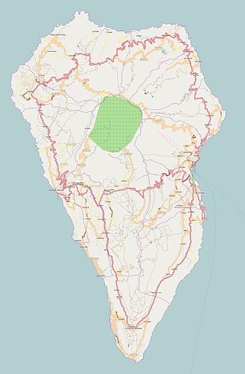
Map
See also
References
- ^ Fuencaliente The Lighthouse Directory. University of North Carolina at Chapel Hill. Retrieved March 30, 2016
- ^ a b c Rowlett, Russ. "Lighthouses of Spain: Canary Islands". The Lighthouse Directory. University of North Carolina at Chapel Hill.
- ^ "Faro de Fuencaliente". miguelmansanet.com. Retrieved 20 September 2014.
- ^ "Fuencaliente". History of the Lighthouses. Puertos del Estado. Retrieved 20 September 2014.


