File:SCF-terminus.png
Appearance
SCF-terminus.png (312 × 423 pixels, file size: 568 KB, MIME type: image/png)
File history
Click on a date/time to view the file as it appeared at that time.
| Date/Time | Thumbnail | Dimensions | User | Comment | |
|---|---|---|---|---|---|
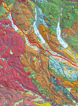
| current | 22:38, 15 February 2010 |  | 312 × 423 (568 KB) | J. Johnson | {{Information |Description={{en|1=Excerpt from U.S. Geological Survey Scientifc Investigations Map 2940, sheet 1, showing general curvature of topography to the southeast around Lakes Keechelus, Kachess, and Cle Elum. where the w:Straight Creek Fault |
File usage
The following 2 pages use this file:
Global file usage
The following other wikis use this file:
- Usage on de.wiki.x.io


