Jump to content

File:Richmond-San Rafeal Bridge.jpg

Page contents not supported in other languages.
This is a file from the Wikimedia Commons
From Wikipedia, the free encyclopedia

Original file (1,200 × 1,200 pixels, file size: 197 KB, MIME type: image/jpeg)

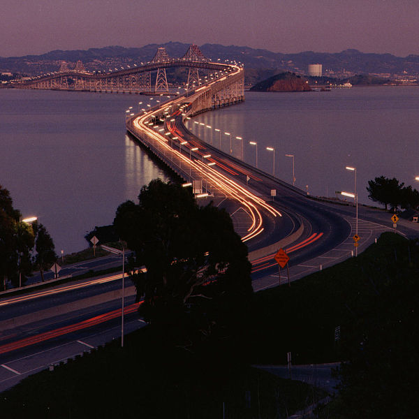
Description Richmond-San Rafael Bridge facing east.
Source http://www.dot.ca.gov/hq/traffops/hwybrdg/tollbridge/History/richmond.html
Author Caltrans staff
Permission
(Reusing this file)

From the Caltrans web site is this posting:

OWNERSHIP In general, information presented on this web site, unless otherwise indicated, is considered in the public domain. It may be distributed or copied as permitted by law. However, the State does make use of copyrighted data (e.g., photographs) which may require additional permissions prior to your use. Furthermore, the unique branding of the site and various official seals and marks may not be used without permission of the State.

There is no indication that this is a copyrighted work that requires additional permission.


Public domain
Public domain
This media file is in the public domain in the United States. This applies to U.S. works where the copyright has expired, often because its first publication occurred prior to January 1, 1929, and if not then due to lack of notice or renewal. See this page for further explanation.

United States
United States
This image might not be in the public domain outside of the United States; this especially applies in the countries and areas that do not apply the rule of the shorter term for US works, such as Canada, Mainland China (not Hong Kong or Macao), Germany, Mexico, and Switzerland. The creator and year of publication are essential information and must be provided. See Wikipedia:Public domain and Wikipedia:Copyrights for more details.
Camera location37° 56′ 38.29″ N, 122° 29′ 01.87″ W Kartographer map based on OpenStreetMap.View this and other nearby images on: OpenStreetMapinfo

Captions

Add a one-line explanation of what this file represents

Obiekty przedstawione na tym zdjęciu

depicts

37°56'38.288"N, 122°29'1.871"W

File history

Click on a date/time to view the file as it appeared at that time.

Date/TimeThumbnailDimensionsUserComment
current22:18, 26 July 2006Thumbnail for version as of 22:18, 26 July 20061,200 × 1,200 (197 KB)WikiLeon{{Information |Description= |Source=http://www.dot.ca.gov/hq/traffops/hwybrdg/tollbridge/History/richmond.html |Date= |Author= |Permission=From the Caltrans [http://www.caltrans.ca.gov web site] is [http://www.caltrans.ca.gov/conditions.htm this posting]:

Global file usage

The following other wikis use this file:

Metadata