
File:Old map of Lviv (cropped).jpg
Size of this preview: 800 × 463 pixels. Other resolutions: 320 × 185 pixels | 640 × 371 pixels | 1,024 × 593 pixels | 1,280 × 741 pixels | 2,560 × 1,482 pixels | 3,582 × 2,074 pixels.
Original file (3,582 × 2,074 pixels, file size: 488 KB, MIME type: image/jpeg)
| This is a file from the Wikimedia Commons. Information from its description page there is shown below. Commons is a freely licensed media file repository. You can help. |
Summary
| Description |
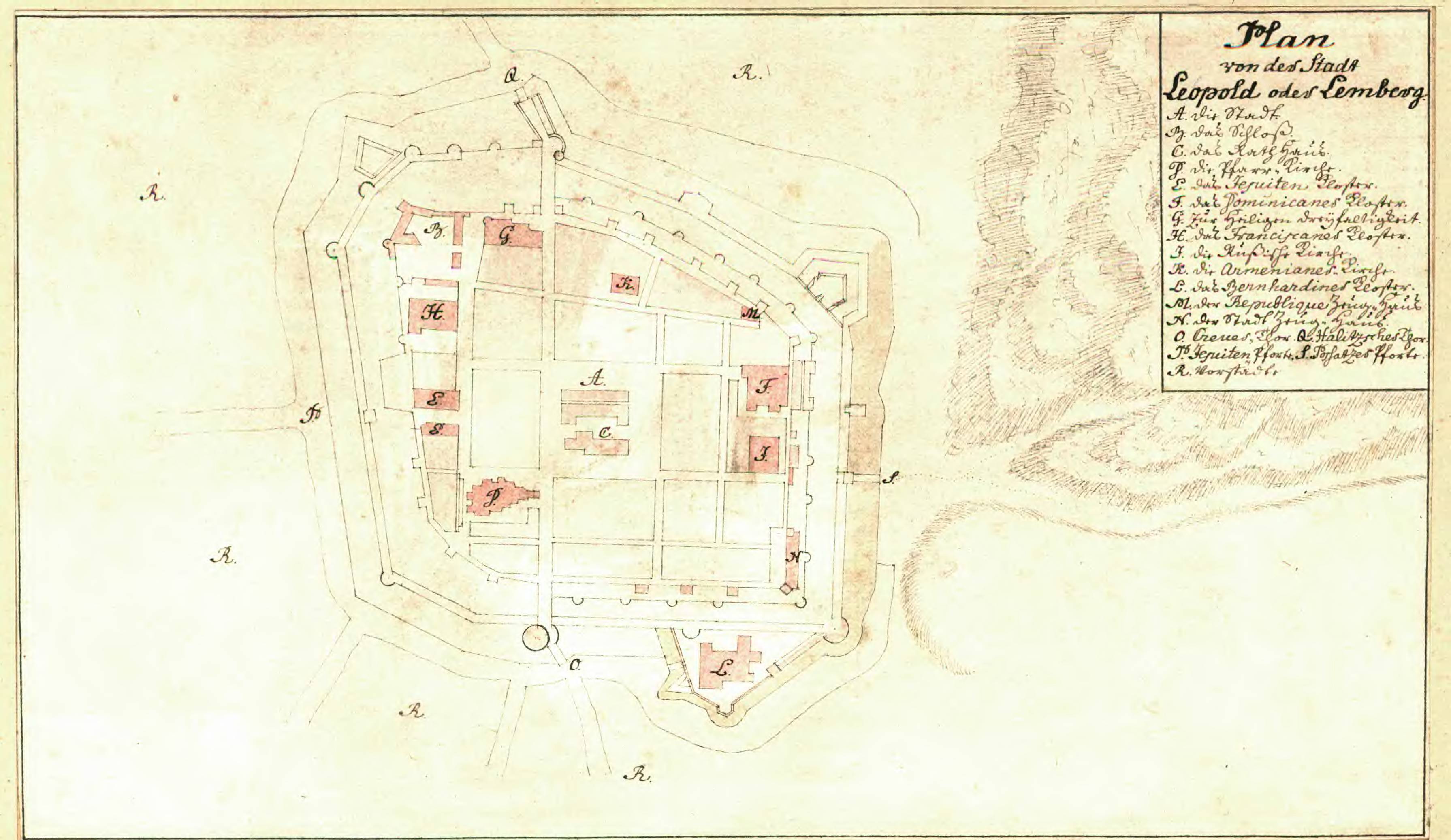
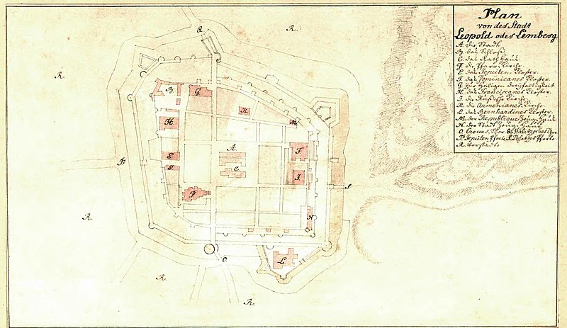
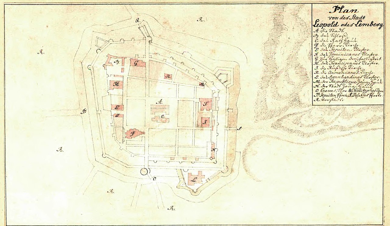
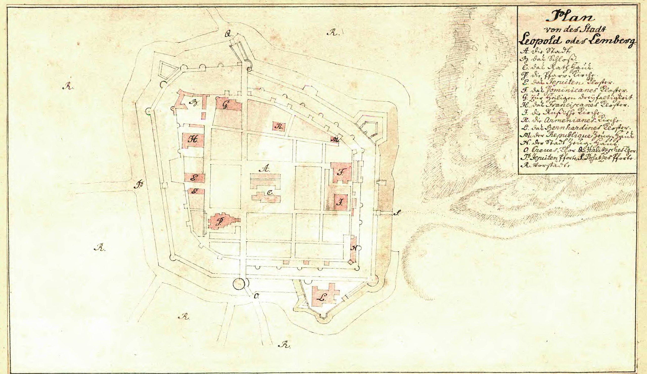
English: 18th century map of the city Leopold/Lemberg/Lwow/Lviv
Svenska: 1700-talskarta över staden Leopold/Lemberg/Lwow/Lviv |
|||||||||||||||||||||||||||||
| Date | ||||||||||||||||||||||||||||||
| Source |
https://sok.riksarkivet.se/arkiv/HH9crAPXRqo4x4Cou3ywt2
|
|||||||||||||||||||||||||||||
| Creator |
Unknown author |
|||||||||||||||||||||||||||||
| Georeferencing | If inappropriate please set warp_status = skip to hide. | |||||||||||||||||||||||||||||
| Other versions | ||||||||||||||||||||||||||||||


.jpg)
Licensing
|
This work is in the public domain in its country of origin and other countries and areas where the copyright term is the author's life plus 70 years or fewer. | |
| This file has been identified as being free of known restrictions under copyright law, including all related and neighboring rights. | |
File history
Click on a date/time to view the file as it appeared at that time.
| Date/Time | Thumbnail | Dimensions | User | Comment | |
|---|---|---|---|---|---|
| current | 13:32, 18 March 2022 | | 3,582 × 2,074 (488 KB) | Julle | File:Old map of Lviv.jpg cropped 21 % vertically using CropTool with lossless mode. |
File usage
The following pages on the English Wikipedia use this file (pages on other projects are not listed):
Global file usage
The following other wikis use this file:
- Usage on mt.wiki.x.io
.jpg)