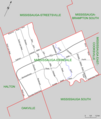
File:Mississauga-Erindale (riding map).png
Appearance

Size of this preview: 507 × 600 pixels. Other resolutions: 203 × 240 pixels | 406 × 480 pixels | 649 × 768 pixels | 1,051 × 1,243 pixels.
Original file (1,051 × 1,243 pixels, file size: 267 KB, MIME type: image/png)
File history
Click on a date/time to view the file as it appeared at that time.
| Date/Time | Thumbnail | Dimensions | User | Comment | |
|---|---|---|---|---|---|
| current | 20:40, 21 January 2008 |  | 1,051 × 1,243 (267 KB) | Slyguy~commonswiki | {{Information |Description=Map of the Ontario federal and provincial riding of Mississauga-Erindale. Boundaries defined in 2003, and adopted federally in 2004 and provincially in 2007. |Source=Self-made, based on [http://www.elections.ca/scripts/pss/PopU |
File usage
The following 2 pages use this file:
