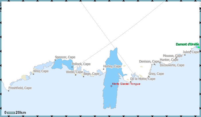
File:Mertz Glacier Tongue map.png
Appearance
Mertz_Glacier_Tongue_map.png (700 × 410 pixels, file size: 22 KB, MIME type: image/png)
File history
Click on a date/time to view the file as it appeared at that time.
| Date/Time | Thumbnail | Dimensions | User | Comment | |
|---|---|---|---|---|---|
| current | 13:20, 27 February 2010 |  | 700 × 410 (22 KB) | Ratzer | {{Information |Description={{en|1=map of Mertz Glacier Tongue, George V Coast, East Antarctica}} |Source=http://gisdata.usgs.gov/website/antarctic_research_atlas/viewer.htm |Author=USGS |Date=2000s |Permission= |other_versions= }} [[Category:Maps of Anta |
File usage
The following page uses this file:
Global file usage
The following other wikis use this file:
- Usage on ar.wiki.x.io
- Usage on es.wiki.x.io
- Usage on fr.wiki.x.io
- Usage on he.wiki.x.io
- Usage on it.wiki.x.io
- Usage on ka.wiki.x.io
- Usage on nn.wiki.x.io
- Usage on sv.wiki.x.io
- Usage on www.wikidata.org
- Usage on zh.wiki.x.io


