
File:Map by Fredericus de Wit with Europa personification.jpg
No higher resolution available.
Map_by_Fredericus_de_Wit_with_Europa_personification.jpg (723 × 526 pixels, file size: 452 KB, MIME type: image/jpeg)
| This is a file from the Wikimedia Commons. Information from its description page there is shown below. Commons is a freely licensed media file repository. You can help. |
| Description |
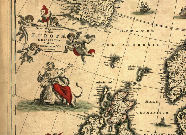
English: A map made by Fredericus de Wit in the second half of the seventeenth century that shows the mythological Europa as the personification of the continent. Mappe monde & Continents Nova et accuratatotius Europae descriptio, Amstelrodami. Etch on cupper, 48-57,5 cm |
| Date | Second half of the seventeenth century |
| Source | http://www.europesname.eu/index2.html |
| Author | Ssolbergj |
|
This is a faithful photographic reproduction of a two-dimensional, public domain work of art. The work of art itself is in the public domain for the following reason:
The official position taken by the Wikimedia Foundation is that "faithful reproductions of two-dimensional public domain works of art are public domain". This photographic reproduction is therefore also considered to be in the public domain in the United States. In other jurisdictions, re-use of this content may be restricted; see Reuse of PD-Art photographs for details. {{PD-Art}} template without license parameter: please specify why the underlying work is public domain in both the source country and the United States
(Usage: {{PD-Art|1=|deathyear=''year of author's death''|country=''source country''}}, where parameter 1= can be PD-old-auto, PD-old-auto-expired, PD-old-auto-1996, PD-old-100 or similar. See Commons:Multi-license copyright tags for more information.) | ||||
File history
Click on a date/time to view the file as it appeared at that time.
| Date/Time | Thumbnail | Dimensions | User | Comment | |
|---|---|---|---|---|---|
| current | 01:04, 31 October 2012 | | 723 × 526 (452 KB) | Ssolbergj | . |
| 20:04, 30 October 2012 |  | 567 × 518 (281 KB) | Ssolbergj | Rv. This version is of a better quality. If you want to see the whole map, see File:Nova et accurata totius Europæ descriptio.jpg. | |
| 17:07, 25 October 2012 |  | 851 × 708 (403 KB) | AnonMoos | Reverted to version as of 02:29, 4 June 2011 -- preceding version is less yellowed, covers wider area of map | |
| 09:25, 25 October 2012 |  | 567 × 518 (281 KB) | Ssolbergj | . | |
| 02:29, 4 June 2011 |  | 851 × 708 (403 KB) | Ssolbergj | {{Information |Description ={{en|1=A map of Fredericus de Wit, 2nd half 17th century, showing the mythological Europa as the personification of the continent. Mappe monde & Continents Nova et accuratatotius Europae descriptio, Amstelrodami. Etch on cup |
File usage
The following pages on the English Wikipedia use this file (pages on other projects are not listed):
Global file usage
The following other wikis use this file:
- Usage on ja.wiki.x.io
- Usage on uk.wiki.x.io