
File:Circle of latitude elevation.svg

Size of this PNG preview of this SVG file: 681 × 599 pixels. Other resolutions: 273 × 240 pixels | 546 × 480 pixels | 873 × 768 pixels | 1,164 × 1,024 pixels | 2,327 × 2,048 pixels | 1,000 × 880 pixels.
Original file (SVG file, nominally 1,000 × 880 pixels, file size: 97 KB)
| This is a file from the Wikimedia Commons. Information from its description page there is shown below. Commons is a freely licensed media file repository. You can help. |
Summary
| Description |
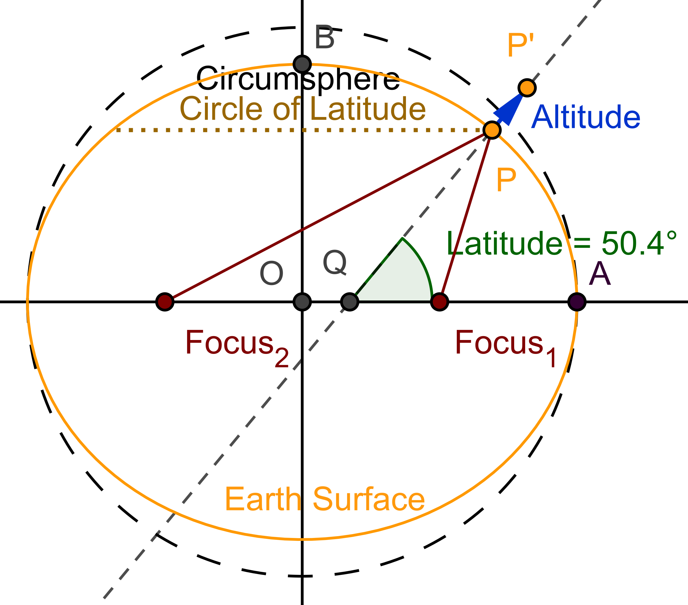
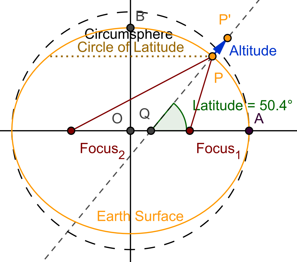
English: Shows that locations of varying elevation are not coplanar with respect to the circle of latitude. |
| Date | |
| Source | Own work. Download source code. |
| Author | SharkD |
| Other versions |
|


Licensing
| I, the copyright holder of this work, release this work into the public domain. This applies worldwide. In some countries this may not be legally possible; if so: I grant anyone the right to use this work for any purpose, without any conditions, unless such conditions are required by law. |
This vector image was created with GeoGebra by v.
File history
Click on a date/time to view the file as it appeared at that time.
| Date/Time | Thumbnail | Dimensions | User | Comment | |
|---|---|---|---|---|---|
| current | 20:06, 3 March 2021 | | 1,000 × 880 (97 KB) | Datumizer | Change scale. |
| 02:28, 22 August 2018 |  | 825 × 825 (93 KB) | Datumizer | Tweaks to fonts. | |
| 02:24, 22 August 2018 |  | 331 × 331 (36 KB) | Datumizer | Deleted a line by accident. | |
| 02:22, 22 August 2018 |  | 331 × 331 (33 KB) | Datumizer | Adjust scale of text, line thickness, etc. | |
| 17:15, 17 July 2018 |  | 640 × 640 (61 KB) | Datumizer | Zoom out. Add spaces to text. | |
| 05:16, 6 August 2008 |  | 400 × 400 (90 KB) | Datumizer | replaced with square, more readable image | |
| 07:56, 17 February 2008 |  | 839 × 642 (66 KB) | Datumizer | {{Information |Description=Shows that locations of varying elevation are not coplanar with repect to the circle of latitude. |Source=self-made |Date=2008-02-17 |Author= SharkD |Permission= |other_versions= }} |
File usage
The following 2 pages use this file:
Global file usage
The following other wikis use this file:
- Usage on ha.wiki.x.io
- Usage on ms.wiki.x.io
- Usage on ru.wiki.x.io