Victor Huot (cartographer)
Appearance
(Redirected from Draft:Victor Huot (cartographer))


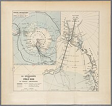
Victor Huot (August 26, 1867 – April 28, 1915) was a French cartographer, who drew maps of various areas including South America[1] and Africa.[2]
Huot worked for publisher Hachette et Cie.[3] He was a member of the Paris Geographical Society and the American Geographical Society.[4][3] He made a map of the Andes.[5] Hout was killed in battle on April 28, 1915.[3]
See also
[edit]References
[edit]- ^ "Regions des Hauts Plateaux de L'Amerique De Sud (Bolivie, Argentine, Chili, Perou) Parcourues Par La Mission Francaise". Ministry of Public Instruction. 1905 – via www.abebooks.co.uk.
- ^ "Revue des questions scientifiques". Société scientifique de Bruxelles. November 10, 1899 – via Google Books.
- ^ a b c "Obituary: Victor Huot". Geographical Review. 1 (3). Taylor & Francis, Ltd.: 226 1916. JSTOR 207625.
- ^ "Huot, Victor (August 26, 1867 – April 28, 1915): Geographicus Rare Antique Maps". www.geographicus.com.
- ^ "1905 Victor Huot Map of the Andes Mountain Region of South America". Geographicus Rare Antique Maps.
