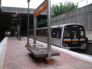
College Park station (MARTA)
This article needs additional citations for verification. (September 2015) |
S6
College Park
| |||||||||||||||
|---|---|---|---|---|---|---|---|---|---|---|---|---|---|---|---|
| MARTA rapid transit station | |||||||||||||||
 College Park Station as seen from the platform | |||||||||||||||
| General information | |||||||||||||||
| Location | 3800 Main Street College Park, GA 30337, U.S. | ||||||||||||||
| Coordinates | 33°39′06″N 84°26′56″W / 33.651673°N 84.448793°W | ||||||||||||||
| Owned by | MARTA | ||||||||||||||
| Platforms | 1 island platform | ||||||||||||||
| Tracks | 2 | ||||||||||||||
| Connections | |||||||||||||||
| Construction | |||||||||||||||
| Structure type | Open-cut | ||||||||||||||
| Parking | 1,883 daily parking spaces 88 long-term parking spaces | ||||||||||||||
| Bicycle facilities | 6 spaces | ||||||||||||||
| Accessible | Yes | ||||||||||||||
| Other information | |||||||||||||||
| Station code | S6 | ||||||||||||||
| History | |||||||||||||||
| Opened | June 18, 1988 | ||||||||||||||
| Passengers | |||||||||||||||
| 2013 | 9,026 (avg. weekday)[1] | ||||||||||||||
| Services | |||||||||||||||
| |||||||||||||||
| |||||||||||||||
College Park is a subway station in College Park, Georgia, United States, serving the Red and Gold lines of the Metropolitan Atlanta Rapid Transit Authority (MARTA) rail system.[2] It opened on June 18, 1988. This station mainly serves College Park and surrounding areas, including Morrow, Riverdale, Clayton County, and South Fulton.
In 2013, College Station had 9,026 average weekday entries, passing up Lindbergh Center to become the third-busiest station, only behind the Airport and Five Points Stations.[3]
History
[edit]College Park Station was opened on June 18, 1988, along with the Airport Station.[4] The Airport Station was built 8 years earlier along with the airport terminal, but remained unconnected until College Park Station was built to connect the two.
Station layout
[edit]College Park Station has 1,883 daily parking spaces and 88 long-term parking spaces.[5] MARTA Bus routes 82, 93, 172, and 180 can be accessed via the north bus bays and routes 89, 189, 195, and 196 via the south bus bays. The buses serve Camp Creek Parkway, Georgia International Convention Center, Old National Highway, Southlake Mall, South Fulton Park & Ride, Fairburn, Palmetto, Sylvan Hills, Union City, Clayton County and Riverdale.
| G | Street Level | Entrance/Exit, fare barriers, bus loops |
| P Platform level |
Southbound | ← Red Line, Gold Line toward Airport (Terminus) |
| Island platform, doors will open on the left | ||
| Northbound | Gold Line toward Doraville (East Point) → Red Line toward North Springs (East Point) → | |
Nearby landmarks & popular destinations
[edit]- Downtown College Park
- Georgia International Convention Center
- Bill Evans Basefield and Bill Badgett Stadium
- U.S. Federal Aviation Administration
- Woodward Academy
References
[edit]- ^ "2014 Transportation Fact Book" (PDF). Atlanta Regional Commission. Retrieved 9 January 2016.
- ^ "Red Line Map:Red Line". itsmarta. Metropolitan Atlanta Rapid Transit Authority. Retrieved July 22, 2015.
- ^ "2014 Transportation Fact Book" (PDF). Atlanta Regional Commission. Retrieved May 11, 2015.
- ^ "MARTA's College Park Station". YouTube. Metropolitan Atlanta Rapid Transit Authority. Archived from the original on 2021-12-22. Retrieved July 22, 2015.
- ^ "College Park". itmarta. Metropolitan Atlanta Rapid Transit Authority. Retrieved July 22, 2015.
External links
[edit]![]() Media related to College Park (MARTA station) at Wikimedia Commons
Media related to College Park (MARTA station) at Wikimedia Commons
- Gold Line (MARTA)
- Red Line (MARTA)
- Metropolitan Atlanta Rapid Transit Authority stations
- Railway stations in the United States opened in 1988
- Railway stations in Atlanta
- 1988 establishments in Georgia (U.S. state)
- Atlanta stubs
- United States rapid transit stubs
- Southern United States railway station stubs
- Georgia (U.S. state) building and structure stubs
- Georgia (U.S. state) transportation stubs

