
Coll
| Scottish Gaelic name | Coll |
|---|---|
| Meaning of name | Hazel |
| Location | |
| File:Coll.PNG | |
| OS grid reference | NM207584 |
| Physical geography | |
| Island group | Mull |
| Area | 7,685 ha |
| Area rank | 18 [1] |
| Highest elevation | Ben Hogh 104 m |
| Administration | |
| Council area | Argyll and Bute |
| Country | Scotland |
| Sovereign state | United Kingdom |
| Demographics | |
| Population | 164 |
| Population rank | 35 [1] |
| Largest settlement | Arinagour |
| References | [2][3][4] |
Coll is a small island, west of Mull in the Inner Hebrides of Scotland. Coll is known for its sandy beaches, which rise to form large sand dunes, for its corncrakes, and for Breachacha Castle.
Geography and geology
Coll is about 21 km long by 5 km wide (13 miles by 3 miles) and has a population of less than 200. The island has a small village, Arinagour, from which ferries operated by Caledonian MacBrayne sail to Scarinish on Tiree and to Oban on the mainland.[5] The journey to Oban normally takes about two hours, but in stormy winter weather it can take much longer.
Coll's sandy beaches rise to form large sand dunes.

History
Coll was home to a branch of the Clan MacLean for 500 years, not all of which were peaceful. In 1590 the MacLeans of Duart invaded their cousins on Coll with the intention of taking the island for themselves. A battle was fought at Breachacha Castle where the Coll clan overwhelmed the Duarts, chopped off their heads and threw them in the stream which is still known as "the stream of the heads".
The Macleans of Coll retained their baronial fief and Castle of Breachacha until 1848 when Alexander Maclean of Coll emigrated to Natal where he died unmarried.
Breachacha Castle on the south coast dates from the fifteenth century. It was restored by the Project Trust,[6] a gap year organisation that sends school leavers abroad for a year's voluntary work. They send 17-19 year olds on a whole year abroad, and have extensive selection and training weeks.[7] An 18th century mansion house stands nearby.
The population of Coll was much higher in the past. In the late 1700s there were about 1,000 people supported by agriculture and fishing.[3] During the Highland Clearances of the 1830s and 1840s, half the population left, many of them moving to Australia, Canada or South Africa.

Wildlife
There is an extensive RSPB reserve towards the west end of the island.[8] One of the main attractions is the rare corncrake. Traditional local farming practices have helped this once common British bird survive.
Coll in fiction
Mairi Hedderwick, the illustrator and author, once lived on Coll and has used the island as the setting her Katie Morag series of children's books. In the books, Coll is known by the fictional name of the Isle of Struay.[9]
External links
- Isle of Coll Website
- BBC Island Blog Website
- Coll Parish Church Website
- The Coll Hotel Website
- The Coll Magazine Archive
- The Coll Community Cenre Project
- The Rise - an up and coming Indie band from Coll
See also
Footnotes
- ^ a b Area and population ranks: there are c. 300 islands over 20 ha in extent and 93 permanently inhabited islands were listed in the 2011 census.
- ^ 2001 UK Census per List of islands of Scotland
- ^ a b Haswell-Smith, Hamish (2004). The Scottish Islands. Edinburgh: Canongate. ISBN 1841954543.
- ^ Get-a-map (Map). Ordnance Survey.
- ^ "route information". Caledonian MacBrayne. Retrieved 2008-01-06.
- ^ "Overview of Coll". Gazetteer for Scotland. Retrieved 2008-01-06.
- ^ "Project Trust". Retrieved 2008-01-06.
- ^ "Guide to Coll". RSBP. Retrieved 2008-01-06.
- ^ "Random House - Mairi Hedderwick". Retrieved 2008-01-06.
Inhabited islands of the Hebrides | ||
|---|---|---|
| Inner Hebrides | 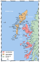 | |
| Outer Hebrides | ||
This Argyll and Bute location article is a stub. You can help Wikipedia by expanding it. |