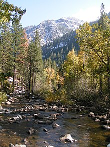
Carson River

The Carson River, named after explorer Kit Carson, is a river in northern California and northwestern Nevada in the United States, approximately 150 mi (241 km) long. It originates in the Sierra Nevada mountains in California, fed by melted snow, and flows generally northeast into Nevada, emptying into the enclosed Carson Sink.
It rises in two forks in the Sierras of northern California. The East Fork rises in southern Alpine County, southeast of Markleeville in the Carson-Iceberg Wilderness. It flows northeast then north into Nevada. The West Fork rises in California Sierras near Carson Pass and flows northeast into Nevada, joining the East Fork near Minden. The combined river flows north, passing through Carson City, then generally northeast past across Lyon County, past Dayton. In eastern Churchill County it is impounded by the Lahontan Dam to form the Lake Lahontan reservoir for irrigation and hydroelectricity. Downstream from the dam the river flow east past Fallon, then northeast into the Carson Sink.
In the 1850s and 1860s, the river was used as the route of the Carson Trail, a branch of the California Trail that allowed access to the California gold fields, as well as by the Pony Express. In the early 20th century, the Newlands project was formed to bring irrigation water into the region for agriculture. The Lahontan Dam was constructed as part of the ongoing project. The Truckee-Carson Irrigation District was formed in 1918 as part of the project to divert water from the Truckee River to the Carson Valley for agricultural use.
Recreation
The East Fork Carson River is a popular recreation spot for fishing, river rafting, mountain biking, off-roading, hunting, and horse-back riding. Development along the river in Douglas, Carson City, and Lyon counties has limited public access in some areas.
