Bulls, New Zealand
Bulls | |
|---|---|
| Coordinates: 40°10′S 175°23′E / 40.167°S 175.383°E | |
| Country | New Zealand |
| Region | Manawatu-Wanganui |
| Territorial authority | Rangitikei District |
| Government | |
| • Mayor | Andy Watson |
| • MP | Ian McKelvie |
| Population (June 2018)[1] | |
• Total | 1,770 |
| Postcode(s) | 4818 |
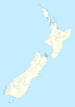
Bulls is a small town near Palmerston North on the west coast of the North Island of New Zealand. It is in a fertile farming area in the Rangitikei District at the junction of State Highways 1 and 3 about 160 kilometres north of Wellington. According to a June 2015 Statistics New Zealand estimate, Bulls has a population of 1,630 inhabitants.[2]
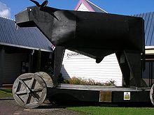
Recent marketing makes puns with the name, for example "New Zealand gets its milk from Bulls" or the sign for the local police station "Const-a-bull".
Etymology

The town is named after James Bull, who founded the town and owned the first general store there. The town was originally called Bull Town, but this was changed to Clifton and then renamed back to Bulls at the urging of Sir William Fox.[3]
History
The eastern end of the State Highway 1 bridge over the Rangitikei River south-east of the town collapsed suddenly in 1973 while being crossed by a bus. No-one was killed and the collapsed part was rebuilt.
The former Lake Alice Psychiatric hospital is 8 km north of Bulls, the hospital closed in 1999. Lake Alice was a large contributor to the Bulls and Marton economy.
Government and politics

Local government
As part of the Rangitikei District, the current Mayor of Rangitikei since 2013 is Andy Watson.[4]
Bulls is the main town in the Bulls ward of the Rangitikei District Council, which elects two of the eleven district councillors. The two councillors of the Bulls ward are Rebecca McNeil and Tim Harris.[5] The mayor and councillors are all due for re-election in October 2016.[6]
National government
Bulls, like the rest of the Rangitikei District, is located in the general electorate of Rangitīkei and in the Māori electorate of Te Tai Hauāuru.[7] Rangitīkei is a safe National Party seat since the 1938 election with the exception of 1978–1984 when it was held by Bruce Beetham of the Social Credit Party. Since 2011 it is held by Ian McKelvie.[8]
Te Tai Hauāuru is a more unstable seat, having been held by three different parties since 1996, i.e. New Zealand First, the Māori Party and the Labour Party.[9] Since 2014 it is held by Adrian Rurawhe of the Labour Party.[10]
Military presence
Many Air Force personnel from RNZAF Base Ohakea used to live in Bulls however in recent years a number of defence houses are being sold to civilian buyers which has seen a steady decline of serviceman from the area.
In 2017 it was announced that the Republic of Singapore Air Force is looking at establishing a permanent F-15 fighter jet training base at Ohakea with an estimated presence of 500 Singaporian personnel. Ohakea and surrounding areas such as Bulls and Feilding would see a significant increase in military families and personnel to the area.[citation needed]
Sister city
The town's sister city is Cowes, England.[11]
Notable people
- Chris Amon, former Formula One driver between 1963–1976
- Travis Banks, professional wrestler
- Ormond Wilson
References
- ^ "Subnational Population Estimates: At 30 June 2019". Statistics New Zealand. 22 October 2019. Retrieved 11 January 2020. For urban areas, "Subnational population estimates (UA, AU), by age and sex, at 30 June 1996, 2001, 2006–18 (2017 boundaries)". Statistics New Zealand. 23 October 2018. Retrieved 23 October 2018.
- ^ Cite error: The named reference
NZ population datawas invoked but never defined (see the help page). - ^ Reed, A. W. (2002). The Reed Dictionary of New Zealand Place Names. Auckland: Reed Books. ISBN 0-7900-0761-4.
- ^ Wallis, Anna (14 October 2013). "Watson wins Rangitikei chain". Wanganui Chronicle – nzherald.co.nz. Retrieved 18 May 2016.
- ^ "Councillors". Rangitikei District Council. Retrieved 18 May 2016.
- ^ "Local Electoral Act 2001". Parliamentary Counsel Office. Retrieved 18 May 2016.
- ^ "Find my Electorate". Electoral Commission. Retrieved 18 May 2016.
- ^ "Rangitīkei Electorate Profile". New Zealand Parliament. 30 September 2012. Retrieved 18 May 2016.
- ^ "Te Tai Hauāuru Electorate Profile". New Zealand Parliament. 30 September 2012. Archived from the original on 10 March 2016. Retrieved 18 May 2016.
{{cite web}}: Unknown parameter|deadurl=ignored (|url-status=suggested) (help) - ^ "Rurawhe, Adrian". New Zealand Parliament. 4 December 2015. Retrieved 18 May 2016.
- ^ Easther, Elisabeth (13 December 2013). "Kia ora: Bulls". The New Zealand Herald.

