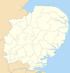
Babergh District
| Babergh District | |
|---|---|
 Shown within Suffolk | |
| Geography | |
| Status: | District |
| Region: | East of England |
| Admin. County: | Suffolk |
| Area: - Total |
Ranked 595.21 km² |
| Admin. HQ: | Hadleigh |
| ONS code: | 42UB |
| Demographics | |
| Population: - Total (2022) - Density |
Ranked / km² |
| Ethnicity: | 98.7% White |
| Politics | |
| Babergh District Council http://www.babergh-south-suffolk.gov.uk/ | |
| Leadership: | Alternative - Sec.31 |
| Control: | |
| MP: | Tim Yeo |
Babergh (pronounced "bay-ber"[1]) is a local government district in Suffolk, England. Its council headquarters is based in Hadleigh, whilst its largest town is Sudbury.[2]
The district was formed on 1 April 1974 by the merger of the Borough of Sudbury, Hadleigh urban district, Cosford Rural District, Melford Rural District and Samford Rural District. It is one of the few English second tier authorities that has never had one party or coalition of parties in control.
Babergh has a population of roughly 85,000 and covers an area of approximately 230 square miles (600 km2).
It is named after the old Babergh hundred, referred to in the Domesday Book. The southern boundary of the district is marked almost exclusively by the River Stour, which also forms the border with Essex, and it is separated from Suffolk Coastal by the River Orwell. Primarily a rural area, Babergh contains only 2 towns of any notable size, namely Sudbury and the administrative centre, Hadleigh.
Most of what is termed Constable Country is contained within Babergh, attracting visitors to the conservation area Dedham Vale and the historic villages of Long Melford, Lavenham and Kersey.
Towns and parishes in Babergh District
References
- ^ "Babergh District Council - Summary".
- ^ Estimates of Total Populations of Areas of Suffolk Suffolk County Council

