Angamuco
| Location | |
|---|---|
| Coordinates | 19°35′03″N 101°29′42″W / 19.5840293°N 101.4948909°W |
| History | |
| Founded | circa 900 CE |
| Cultures | Purépecha civilization |
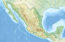
Angamuco is the name given to a major urban settlement of the Purépecha civilization, now in ruins hidden under vegetation, in the Lake Pátzcuaro Basin of Michoacán, Mexico, and discovered in 2007. In 2012, using LiDAR technology, archaeologist Christopher Fisher and team detected an estimated 39,000 buildings at the site, roughly the same as Manhattan, on a territory of approximately 25 square kilometres (9.7 sq mi) (less than half of Manhattan's 59 square kilometres (23 sq mi).[1] Fisher believes the settlement was founded around 900 CE and reached peak importance from around 1000 to around 1350 CE with a population of over 100,000 – making it the most populous city in western Mexico at the time, and spanning a wider area than the Purépecha capital, Tzintzuntzan.[2][3]
References
- ^ "Angamuco, the lost city of Michoacán". El Universal. 1 April 2018. Retrieved 5 November 2019.
- ^ O'Reilly, Andrew (20 February 2018). "Ancient lost city in Mexico had as many buildings as Manhattan". News.com.au. Retrieved 5 November 2019.
- ^ Davis, Nicola (15 February 2018). "Laser scanning reveals 'lost' ancient Mexican city 'had as many buildings as Manhattan'". The Guardian. Retrieved 5 November 2019.

