
Alfalfa County, Oklahoma
Alfalfa County | |
|---|---|
 Location within the U.S. state of Oklahoma | |
 Oklahoma's location within the U.S. | |
| Coordinates: 36°44′N 98°19′W / 36.73°N 98.32°W | |
| Country | |
| State | |
| Founded | 1907 |
| Named for | William H. "Alfalfa Bill" Murray, ninth Governor of Oklahoma. |
| Seat | Cherokee |
| Area | |
• Total | 881 sq mi (2,283 km2) |
| • Land | 867 sq mi (2,245 km2) |
| • Water | 15 sq mi (38 km2) |
| Population (2000) | |
• Total | 6,105 |
| • Density | 7/sq mi (3/km2) |
| Time zone | UTC−6 (Central) |
| • Summer (DST) | UTC−5 (CDT) |
| Congressional district | 3rd |
Alfalfa County is a county located in the U.S. state of Oklahoma. As of 2000, the population is 6,105. Its county seat is CherokeeTemplate:GR. Alfalfa County was formed in 1907 from Woods County. The county is named after William H. "Alfalfa Bill" Murray, the president of the Oklahoma Constitutional Convention and ninth governor of Oklahoma.[1]
History
Indigenous peoples inhabited and hunted in this area for thousands of years. By 1750, the Osage had become a dominant tribe in the area. About one third belonged to the band led by Chief Black Dog (Manka - Chonka). They made the Black Dog Trail before 1800, from Baxter Springs, Kansas to their summer hunting grounds in Oklahoma. It extended east of Baxter Springs to the Great Salt Plains in Alfalfa County.[2] The Osage stopped at the springs for its healing properties on their way to hunting. They cleared the trail of brush and large rocks, and made ramps to the fords. The trail could accommodate eight horsemen abreast and was the first improved road in Kansas and Oklahoma.[3]
Geography
According to the U.S. Census Bureau, the county has a total area of 881 square miles (2,283 km²), of which, 867 square miles (2,245 km²) of it is land and 15 square miles (38 km²) of it (1.68%) is water.
Major highways
Adjacent counties
- Harper County, Kansas (northeast)
- Grant County (east)
- Garfield County (southeast)
- Major County (south)
- Woods County (west)
- Barber County, Kansas (northwest)
National protected area
Demographics
As of the censusTemplate:GR of 2000, there were 6,105 people, 2,199 households, and 1,482 families residing in the county. The population density was 7 people per square mile (3/km²). There were 2,832 housing units at an average density of 3 per square mile (1/km²). The racial makeup of the county was 89.42% White, 4.19% Black or African American, 2.74% Native American, 0.11% Asian, 0.05% Pacific Islander, 1.38% from other races, and 2.11% from two or more races. 2.90% of the population were Hispanic or Latino of any race. 96.7% spoke English and 2.1% Spanish as their first language.
There were 2,199 households out of which 26.90% had children under the age of 18 living with them, 59.30% were married couples living together, 5.70% had a female householder with no husband present, and 32.60% were non-families. 31.00% of all households were made up of individuals and 17.60% had someone living alone who was 65 years of age or older. The average household size was 2.29 and the average family size was 2.86.
In the county, the population was spread out with 19.40% under the age of 18, 6.40% from 18 to 24, 28.70% from 25 to 44, 25.20% from 45 to 64, and 20.40% who were 65 years of age or older. The median age was 42 years. For every 100 females there were 131.00 males. For every 100 females age 18 and over, there were 142.00 males.
The median income for a household in the county was $30,259, and the median income for a family was $35,000. Males had a median income of $24,067 versus $17,944 for females. The per capita income for the county was $14,704. About 11.80% of families and 13.70% of the population were below the poverty line, including 18.30% of those under age 18 and 9.60% of those age 65 or over.
Cities and towns
NRHP Sites
The following sites in Alfalfa County are listed on the National Register of Historic Places:
|
|
References
- ^ http://digital.library.okstate.edu/encyclopedia/entries/C/CO047.html
- ^ Burl E. Self, "Black Dog", Oklahoma Encyclopedia of History and Culture, accessed 5 Nov 2009
- ^ Louis F. Burns, "Osage", Oklahoma Encyclopedia of History and Culture, accessed 5 Nov 2009
External links
Municipalities and communities of Alfalfa County, Oklahoma, United States | ||
|---|---|---|
| City | 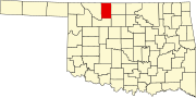 | |
| Towns | ||
| CDP | ||
| Other unincorporated communities | ||