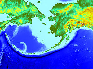
Aleutian Trench
Appearance

The Aleutian Trench is an oceanic trench in the Earth's crust. It is classified as a marginal trench in the east but is termed an island arc west of Alaska. The trench extends for 3,400 km from the northern end of the Kuril-Kamchatka Trench to the Gulf of Alaska, marking the boundary where two tectonic plates meet, a subduction zone where the Pacific Plate is being subducted under the North American Plate. The deepest part of the Aleutian trench has been measured at 7,679 meters (25,194 ft).
The Aleutian arc is a typical oceanic arc of most subduction zones. The angle of dip of the descending lithosphere, which is Pacific Plate, along much of the Aleutian trench is near 45 degree.
